We rolled into Colorado about a week ago and spent the first two nights at a small RV park in Cortez. I didn’t take any pictures of the park, and don’t really have anything to say about it, good or bad. It just was. It served its purpose and that’s all that matters. That purpose was cleaning.
Over the past few months a ridiculous amount of sand and dirt has accumulated in the airstream, and while I do lots of daily cleaning and vacuuming, without full hook-ups it’s hard to really clean. With plenty of water to use I scrubbed all parts of the bathroom, cleaned out the fridge, took everything out of the kitchen cabinets and wiped them down, cleaned the stove and vent hood really well, and vacuumed like a mad lady.
Tim also flushed out our grey and black water tanks. As a bonus the park had surprisingly fast WiFi that Tim took advantage of for a work related project. The best part was that with our Passport America membership we only payed $18/night to stay there. Not bad for two days of cleaning.
Okay, on to the good stuff. This is where we moved to next.
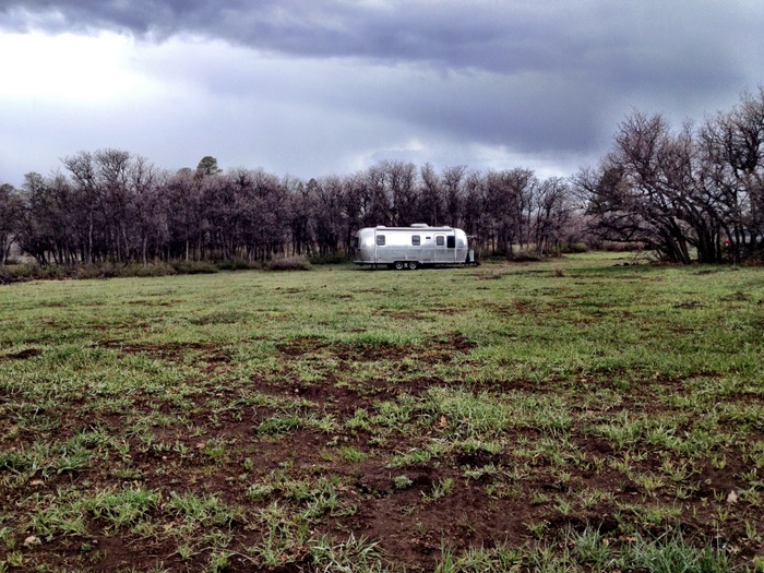
A meadow of our very own
We discovered this dispersed camping (free) spot on the site Freecampsites.net. We’ve had mixed results using this website. In general we’ve found that some of the info on there is out of date, or sometimes just plain wrong. I guess that’s what happens when you have a database of free, and almost free, camp sites submitted by users. This time it was spot on though. The directions and sites descriptions were perfect and we easily found ourselves a great spot. Here’s a map link to where we are. There are several other good spots nearby, some even suitable for rigs much larger than us.
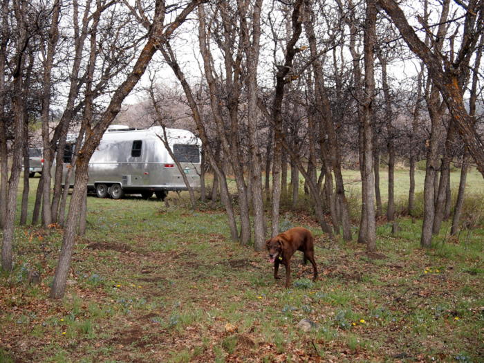
Through the trees
The most difficult part was finding an area of the meadow that was somewhat level. After driving around in a circle we settled on a spot near the edge of the trees, and with only a few blocks managed to level the trailer. The downside was that we ended up in a slightly muddy area. Since it was raining when we arrived, we (by we I mean Phineas) immediately tracked mud inside. So much for our super clean Airstream. Eventually the rain stopped and after only one day of sunny skies the mud dried out.
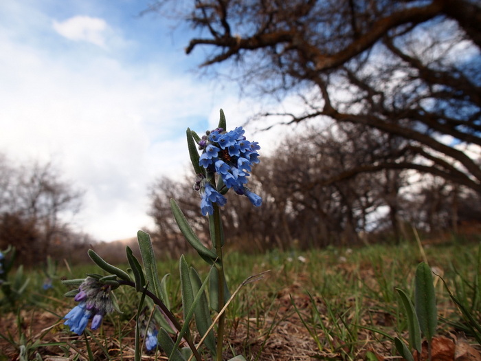
Forget-Me-Not
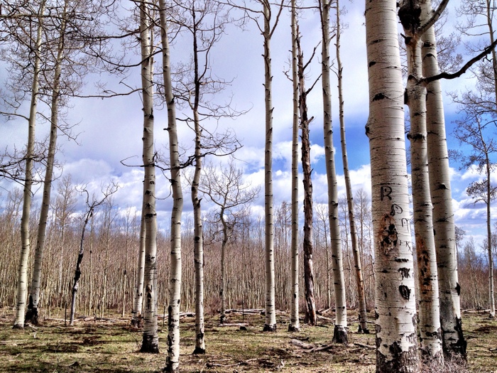
We’re up at ~8,200 feet and signs of spring are just starting to appear. The grass in the meadow is greening up nicely, but the short trees that surround us, called Gambel or Scrub Oak, are not yet showing any leaves. We took a drive up the forest road that passes our site and found the hillside covered with an Aspen forest. There was not even a speck of green anywhere.
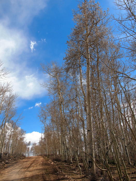
No leaves in sight up here
The forest had obviously been logged at some point and was in various stages of re-growth.
New Aspen trees filling in a recently logged forest
As we climbed higher a very recently logged area with no new trees offered us a view of the valley below.
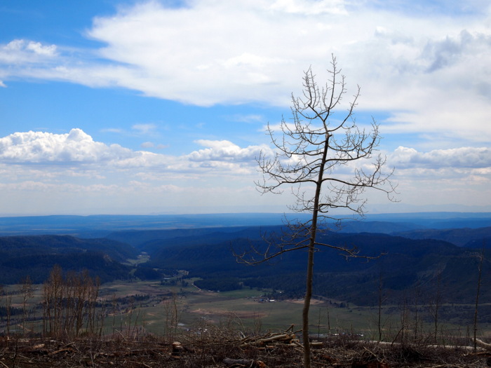
Valley View
Eventually we reached 10,000 feet and some snowy mountains.
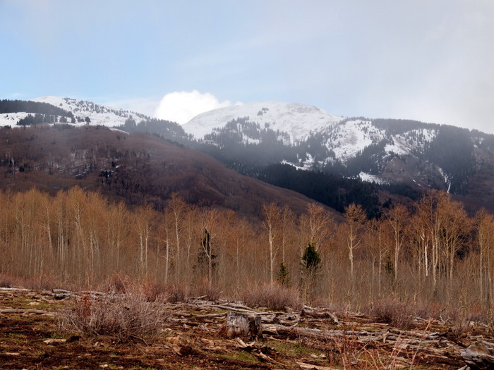
snowy mountains
We also spotted some patches of snow on the ground and let Phineas out for a bit of fun. He remembered exactly what to do with the white stuff.
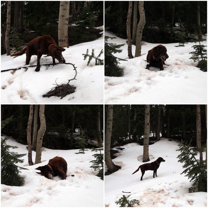
Sweet, sweet snow
We’ve been amusing ourselves around camp by hiking on the numerous trails and roads nearby. The Rio Grande Southern Railroad (RGS) once ran through this area, and while the tracks were abandoned in the early 50s, the pathway through the forest created by the narrow gauge railroad is still alive and well in the form of national forest roads and hiking/biking trails.
The RGS twisted and turned its way through Colorado’s mountains and forests for 162 miles from Ridgeway to Durango. It opened for business in 1890 and closed down in 1954. For most of its existence the railroad struggled to survive, fighting ever constant financial burdens, the silver Panic of 1893, and the great depression. Today you can still find remains of the RGS scattered along the former route. From old depots to trestle bridges, bunkhouses, water towers and sections of untouched track, the railroad remnants are still there for those who care to find them.
Here in the area east of Mancos, the remains of a railroad water tower can be found tucked down in the forest alongside a stream. We came across the tower on one of our hikes. Unfortunately, we didn’t know the significance of the building at the time and neglected to take any photos. We did, however, take pictures of the lovely stream and our very happy dog enjoying it.
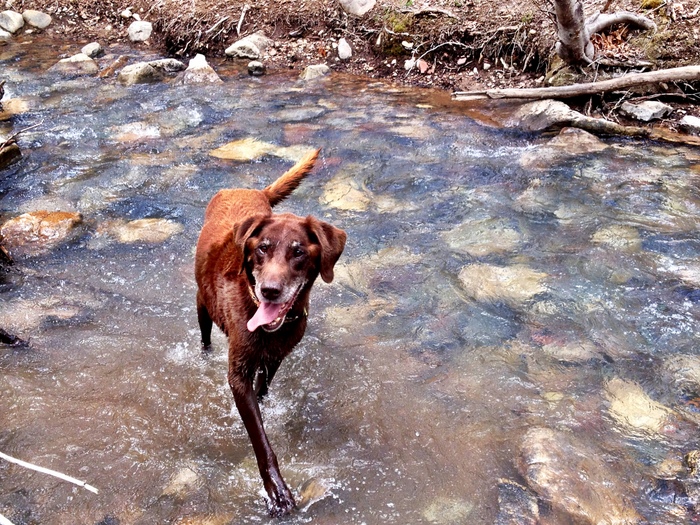
Happy in the stream
Yesterday our afternoon hike took us along the section of the old railroad the runs east from Mancos to Durango. After a few miles we came upon a spur trail that traveled south to the Target Tree National Forest Campground. This had been one our options for a place to camp if the dispersed camping didn’t pan out. It was a nice enough campground with wooded sites. But for $18/night with no hook-ups, and not even any potable water because the spigots are not yet turned on for the year, it doesn’t seem worth it.
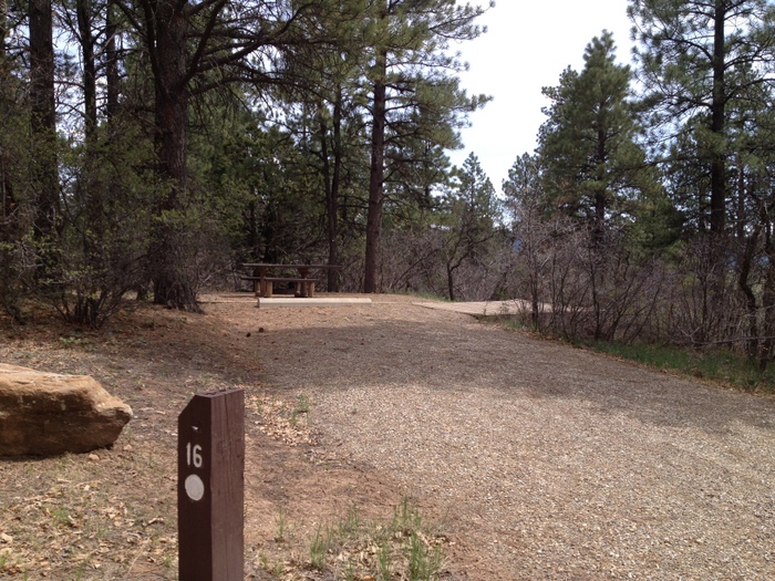
One of the sites at Target Tree
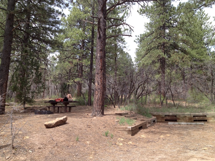
Tim using the picnic table at site 15 for a little nap
Especially not when we can find a spot like this for free!
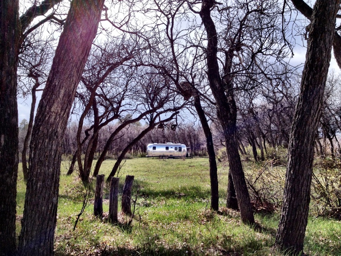
Free camping rocks
Tomorrow we’re going on a scouting mission to seek out a camping area a bit closer to Durango. While we love our spot here, we plan on staying in this area until the end of May and would like to be closer to town. Right now we’re about 20 miles west of Durango and about 25 miles east of Cortez. The tiny towns of Mancos and Hesperus are nearby, but there doesn’t appear to be anywhere to get fresh water which will eventually be a problem. We probably won’t move until near the end of the week though because this place is so enjoyable.
7 comments
It seems like you got cell/data from that free spot. I’m so glad you’re out their scouting, we’ll be camping there in October (weather permitting).
You can see the towers up on a ridge about 2 miles away.
I messed with our “Where” page a bit. Added a table of all the sites we have been. Clicking the google map icon will show the gps coords.
We were hoping to find a spot a little bit closer to Durango, but as far as free camping goes, this appears to be about the closest.
That small, unremarkable campground in Cortez will forever be a special place to us because it was where we were on our initial one-year trip when we decided to ditch our house and hit the road full-time.
I was researching this same spot; seems to be the only dispersed camping in the area. It looks great though!
I have a question though, was it difficult to get to? As far as road conditions go? Our first two and only boondocking experiences have gone terribly (our last resulted in a destroyed bumper, a bent leveling jack with the foot torn off and our water spigot was ripped off).
We’re heading down this afternoon and might go for it, otherwise we’ll be at Echo Basin Ranch in Mancos. Hope to see y’all soon!
Thanks for finally writing about >Madden Peak Road,
Colorado – WatsonsWander <Loved it!
Enjoying your blog and love the maps! Living near the NM/CO state line, hubby and I decided to check out the location you gave for Madden Peak. We found it without any trouble. While there were already several campers there, we decided to go on up to our favorite spot past Jersey Jim’s Lookout Tower in Mancos (Forest Road 561). It’s SO much prettier there, beautiful views, aspen and pine, hiking and OTV trails, with all kinds of spaces for both small and large rigs and groups. We camped near a shallow running stream with a small waterfall and our lab was in water heaven! While we don’t need cell reception when getting away, I had Verizon service while my hubby had none with AT&T. You really should check that area out, you won’t be disappointed!
Sounds fantastic! We will definitely check that out the next time we’re in the area. Thanks so much for the info.