Well this is it — our final stop in Utah. Over the last six weeks we’ve camped on a windy beach, hiked to the top of the world, frolicked in the land of arches, and gone back in time to see how people used to live. Each new destination had us gasping in awe at the wonders Utah has to offer. I think Tim put it best when he so eloquently declared “What’s up Utah? Why’d you get all the cool stuff?” Seriously. This is one cool state.
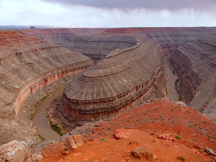
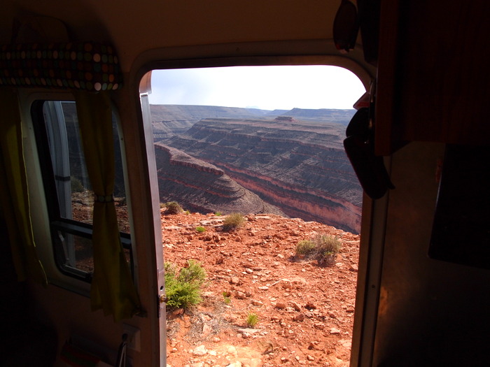
Our last destination brought us only ~100 miles east of where we first entered Utah at the bottom of Lake Powell. Goosenecks State Park is a free park near the southern edge of Utah only about 25 miles north of Monument Valley. That’s right, I said free. Free to camp, free to picnic, or free to just peer over the edge at the San Juan River nearly 1000 feet below.
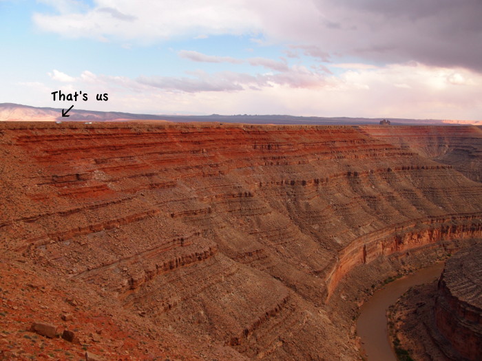
For a stretch of six miles the San Juan River flows through a series of tight turns- known as Goosenecks- over a distance of only one and half miles. An ariel view of the area shows the incredible path that the river has carved in the rocks. The park sits at the edge of one of these turns and offers up a viewing area with railing, a picnic shelter, a pit toilet, and a long stretch of road where you are free to camp.
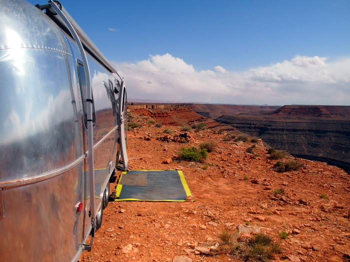
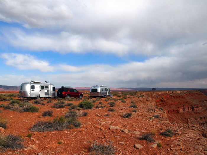
We chose a spot near the edge of the cliff with an awesome view of the deep canyon below.
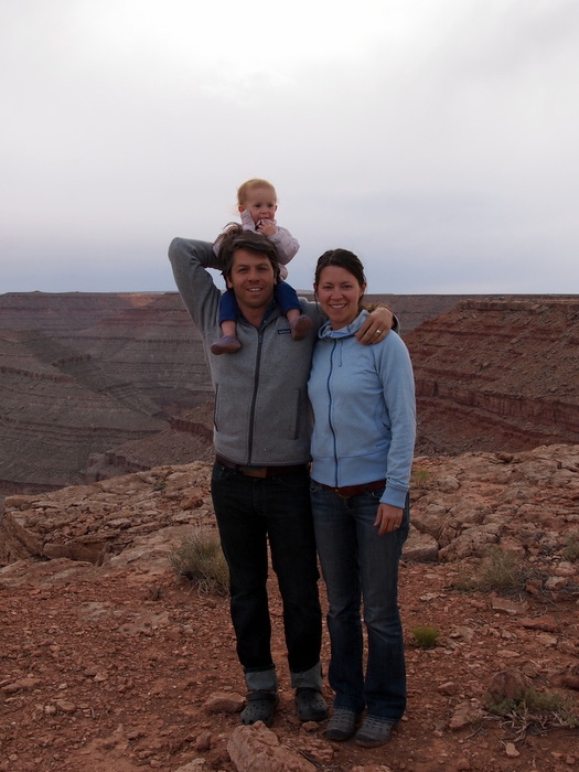
Our second night at Goosenecks we were joined by some fellow airstream travelers. This family of three + one dog live in California and travel whenever possible in their cute 19′ Bambi. They contacted us back when we were in Zion asking for some advice on the area and the logistics of traveling with dogs. We’ve been keeping track of each other through our blogs and Facebook pages ever since, and somehow ended up at Goosenecks on the same night.
Dave, Ann, Wynne and pooch Gorilla (not pictured) pulled up just in time for us to enjoy a delicious group dinner. I was already in the middle of preparing a Lentil Cottage Pie, and they generously offered up some delicious ground pork from the pigs they raise on their mini-farm back in CA. It was a great addition to the meal and I am not sure if this dish will ever be as tasty again. Somehow in the lentil vs. pork battle, the pig wins every time.
We spent the evening trading travel stories and plotting where we might possibly meet up again. As always, it was wonderful to meet like-minded travelers and we sincerely hope to cross paths again in the near future. And hey, you never know, the next time we’re in CA we might just pop in for some more of that tasty pork!
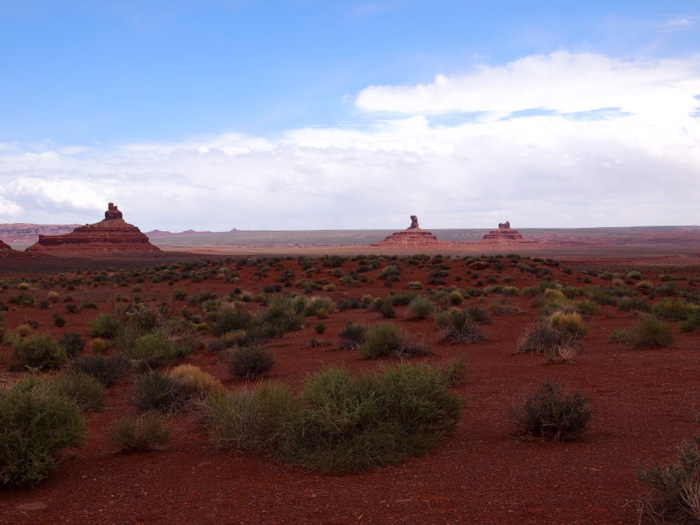
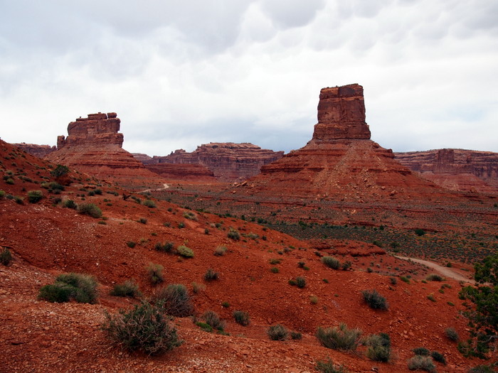
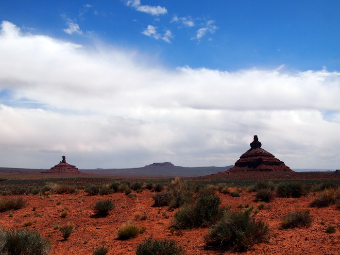
Our two days at Goosenecks were not so great in terms of weather, but we did manage to get out and take a drive on the famed Valley of the Gods Road. Originally the plan was to boondoock on the VOG road. The are numerous spots along the seventeen-mile road with gorgeous views all around. We changed our plan when the rain rolled in though. I was scared off by the folks on numerous RV forums who warned of wet, muddy roads and stuck RVs.
After driving it with just the truck I can see why people with RVs would want to avoid the western portion of the road — in any weather. The road makes several deep dips that probably would have resulted in some sort of trailer damage had we attempted it. The east end of the road, however, is easily passable for any size rig. We spotted a few huge, gorgeous boondocking spots that would have been perfect for us. After leaving Goosenecks we almost moved over to the VOG for a night, but we were running low on both water and food so decided to move on. Next time we’ll be finding a spot on the eastern end of this road for sure.
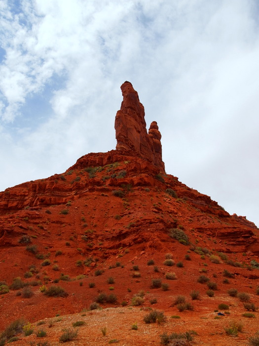
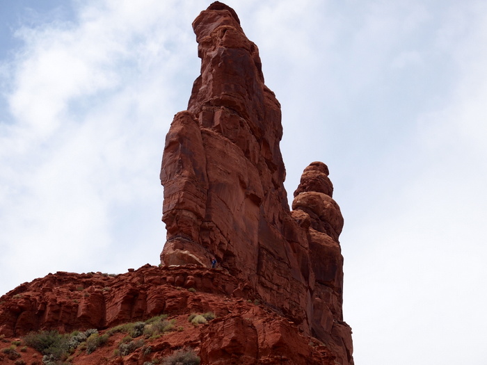
Tim bravely climbed up to the base of this rock in search of a Geocache. Can you see him at the base of the pointy part? He’s the tiny blue speck. Unfortunately, after climbing all the way up there the Geocache was nowhere to be found.
Phineas and I waited for him about halfway up the rock. The view was incredible.
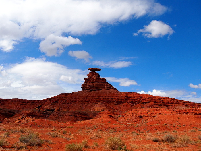
After the Valley of the Gods Road we drove a few miles south of the park to see the famous Mexican Hat Rock that the town of Mexican Hat is named for. The rock was cool, but the town itself didn’t warrant any photos.
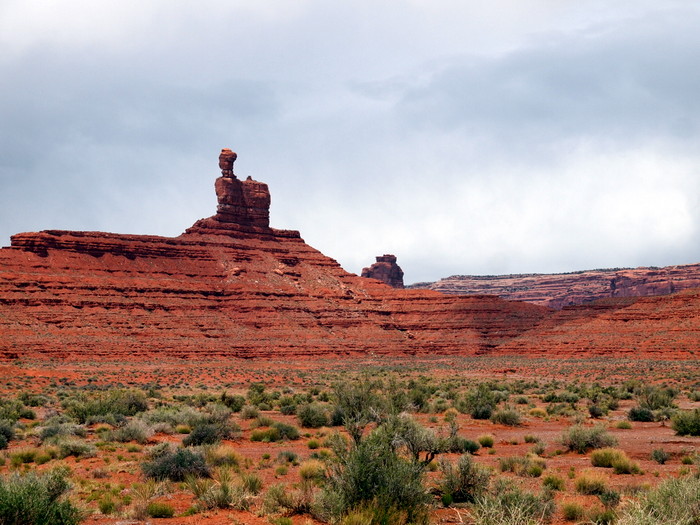
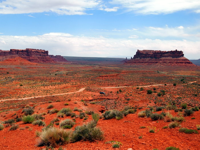
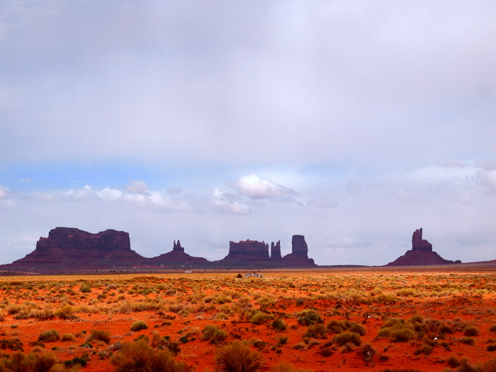
Monument Valley was only about 20 miles south of Mexican Hat, so we figured why not go see it. By the time we arrived the weather was pretty grim and we decided not to pay the fee to enter the visitor center and viewing area. Instead, we took some photos from the side of the road. The light was really strange so only one photo is worth sharing here. I think on a better weather day Monument Valley would be fun to explore, but if you’re looking to avoid crowds and have a more up close and personal experience with the rocks, the Valley of the Gods Road is the way to go.
There you have it. Our last stop in Utah. See you down the road in Colorado…

7 comments
That’s amazing. Is there cell service???
Not anything usable. We got enough AT&T for texting and some slooow internet use, but that’s it. There is a $10/night BLM campground down the road in Bluff that had good service though. I think if we returned this is where we would stay.
Hey I really LIKED your Monument Valley shot! Very interesting light in that photo. Totally shows off the red and rocks. Looking forward to some green pics from you in CO.
Nina
Thanks Nina! That was the best shot for sure. After that the clouds got really thick and the sky far too dark. Green pics from CO will be coming soon :)
Hey Amanda,
If you went back you say you would go to VOG, is that only because you went to Goosenecks the last time? Which would you recommend for a first time stay?
I think Valley of the Gods was more interesting. But they are pretty close together, so if you stayed there you could easily drive over to Goosenecks to see it. Also, I don’t think it’s free to camp there anymore (at Goosenecks).
Looks like it’s $10 night – that makes our decision easy! Thanks Amanda.