Sunday, October 22
We’ve been going back and forth all week about where to go next. With plans to meet up with family in Zion National Park for Thanksgiving, we don’t want to stray too far from the general area. Since we’ve already spent a lot of time in the Zion area, we don’t want to head that way quite yet, but we also don’t want to have to drive far to get back there. Earlier in the week, we thought we might move over to the boondocking spot I found in Red Canyon, but I decided I needed a change — and some warmer temperatures.
So we meandered our way south on 89 to check out some boondocking in Mt. Carmel Junction. This tiny little town on the east side of Zion should offer us some hiking opportunities, plus Kanab is only 20 minutes away for any errands we might need to run. Also, at less than 6,000 feet elevation the weather should be much warmer than up here in Bryce.
A quick and easy hour-long drive took us south down Hwy 89 past a few tiny towns to Twin Hollows Road. Much to our surprise, out of the half dozen or so sites on this road, only a single open spot was left. Kind of unusual for a Sunday.
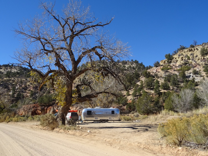
Found a spot with a spooky tree just in time for Halloween
As we were setting up a guy on an ATV stopped by to tell us that deer hunting season had just started that day. I guess that explains all the RVs and ATVs. He wanted to be sure that we wouldn’t be alarmed if we heard gunshots. Gunshots are always alarming no matter what time of year, but it was nice of him to warn us.
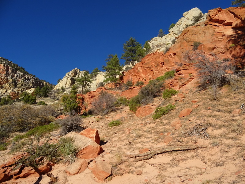
Deer hunting season means that we really don’t want to do any wandering around in the forests around here, but we could still go for a hike inside the national park. Instead of driving all the way into Zion and hiking a trail we had already hiked (we’ve done a LOT of hiking in Zion) we chose a new to us trail that starts at the end of a long winding dirt road just outside the park boundary.
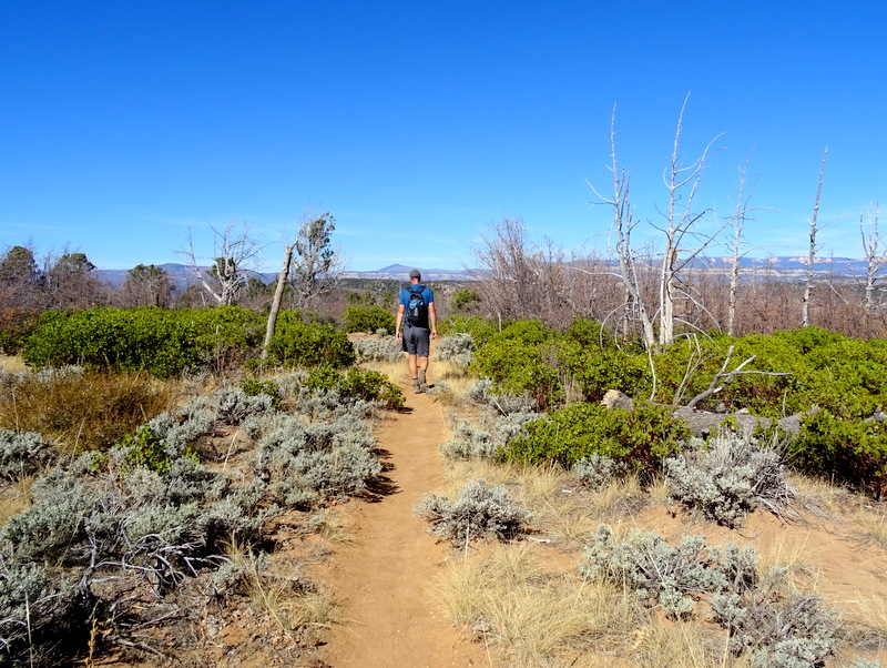
Easy hiking
The Cable Mountain Trail travels for a little more than 3.5 miles to a point overlooking the main canyon of Zion NP. The trail has a little elevation gain and loss, but for the most part was an easy, pleasant stroll through low growing sagebrush and trees already sporting their winter look.
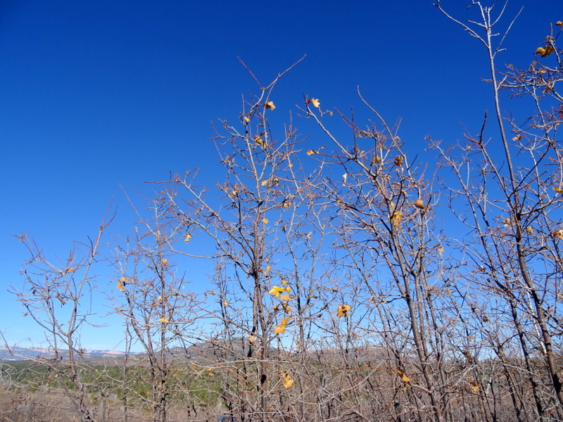
Looks like fall is over up here
At the edge of the canyon, we found the remains of the Cable Mountain Draw Works. This primitive looking contraption was once used to lower lumber 2,000 feet below to the canyon floor. The total trip only took two minutes making it far more efficient than the three days it took to travel overland by wagon. The operation was suspended in 1927 when they ran out of lumber to transport. The towers and cable were removed from the canyon floor, but the original structure remains at the top of the cliff.
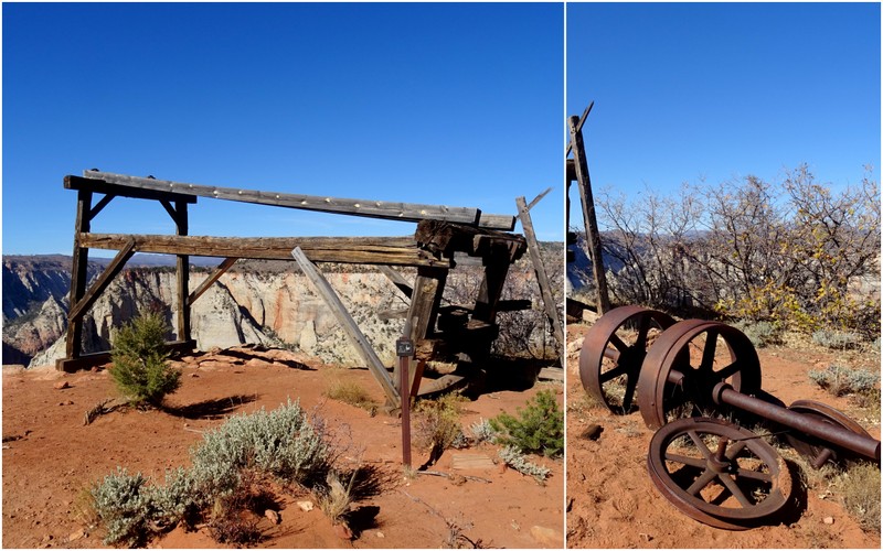
The remains of the Cable Mountain Draw Works
The view from the top of Cable Moutain was very cool. We could see across the canyon to Observation Point, the skinny ridge that makes up the last few miles of the Angel’s Landing trail, and all the way to the bottom of the canyon.
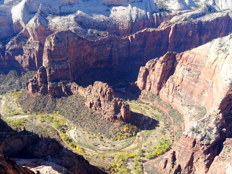
Looking down into Zion Canyon. Can you see the shuttle bus way down there?
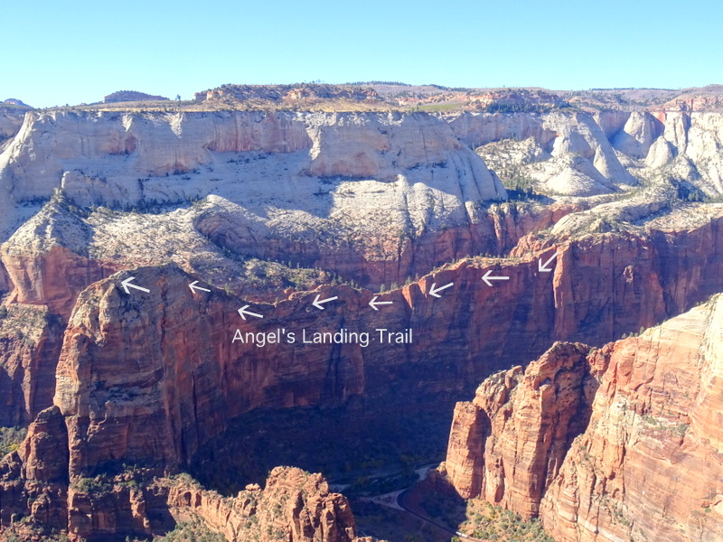
A cool view of the Angel’s Landing trail from above
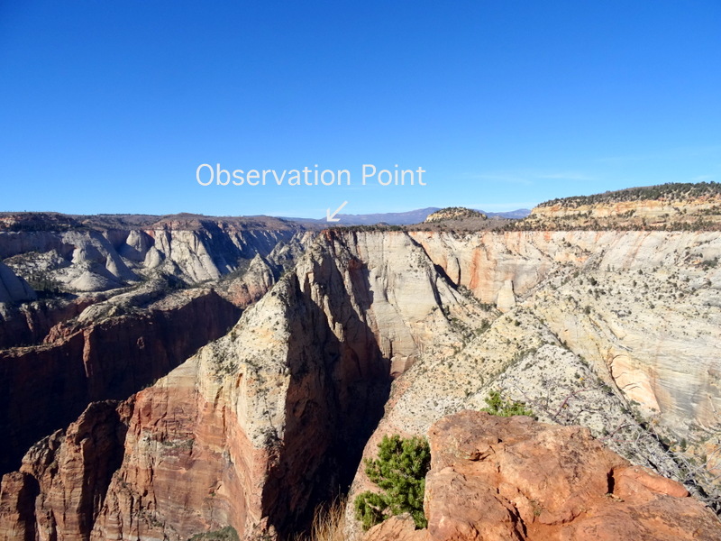
Looking across the canyon at Observation Point
We’ve hiked up to Observation Point twice and it might just be our favorite hike in the park. Seeing the trail across the canyon was really cool. Especially when I noticed that you could see the section of switchbacks near the top of the trail that are carved into the edge of the cliff.
The switchback section near the top of Observation Point is my very favorite part of this trail!
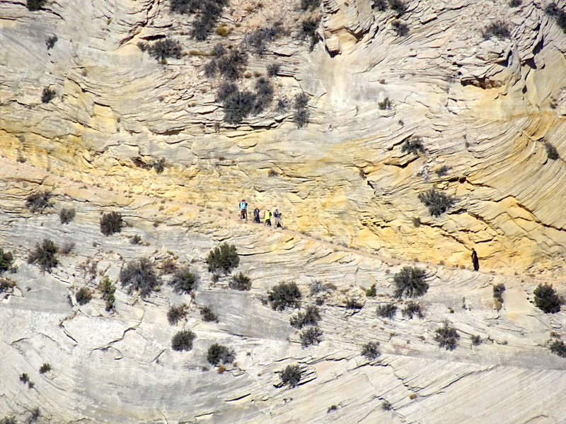
A zoomed view shows hikers on their way down
Monday, October 23
This morning we discovered a disadvantage to our spot in the canyon — the sun doesn’t reach us until 9:45! Fortunately, once it did reach us in warmed up fast any by mid-afternoon it was nearly 80. Yes! l really, really love warm weather.
Instead of going by myself into Kanab for groceries and laundry, I convinced Tim that he should come with me after work. Sometimes going out to do errands on my own is a good way for us both to have a little space, but other times I would much rather have company. Especially when there’s a boring laundromat involved.
Kanab is an interesting small town that seems to be successfully straddling the line between touristy and obnoxious. After finishing the laundry, we went next door to Honey’s marketplace. This is the biggest grocery store we’ve seen since leaving Park City and it felt downright luxurious to have more than one variety of apple and more than one choice of yogurt to choose from.
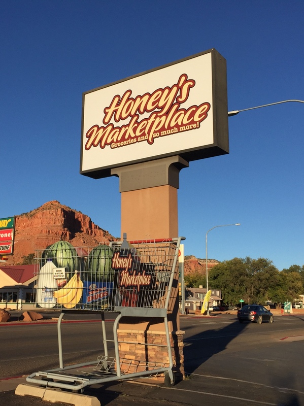
Great sign at Honey’s Marketplace
Tuesday, October 24
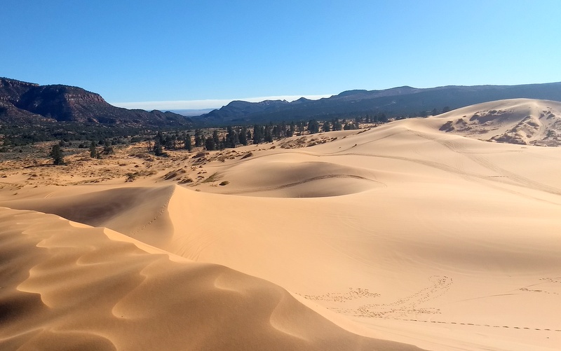
On our way into town yesterday we spotted a sign for the Pink Coral Sand Dunes State Park. We’ve had this park on our radar for awhile now, but with no cell service knew we couldn’t stay there. Well…due to no planning on our part, it turns out that our boondocking spot this week is only a 15-minute drive away.
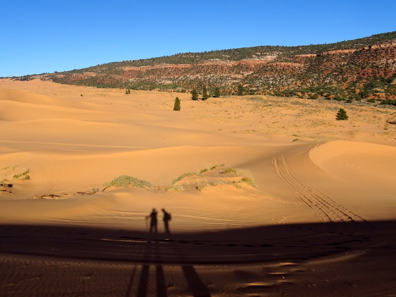
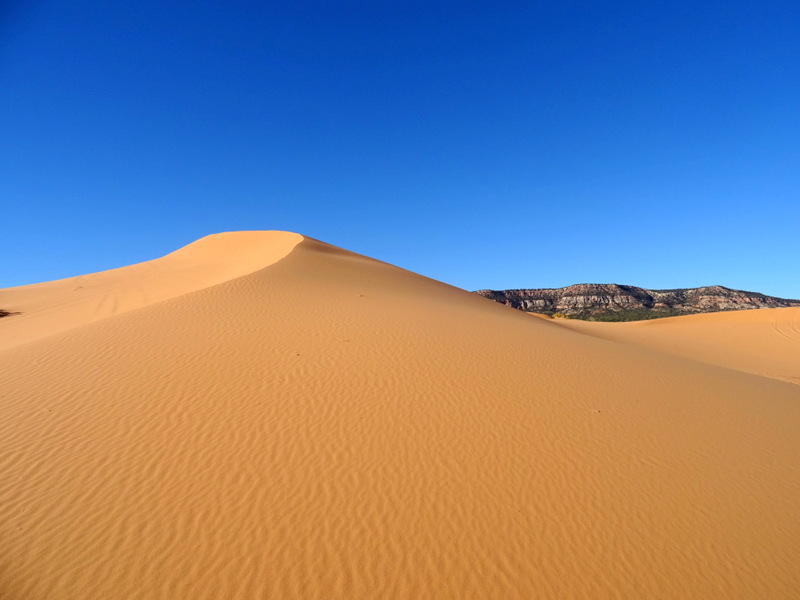
Since the hunters are out in full force around here we thought the state park would be a safe option for our afternoon hike. After paying our $8 entry fee at the gate we parked and suited up for a hike through the dunes. In an effort to keep the sand out I wore my waterproof hiking shoes while Tim went with regular old running shoes. He had to take them off and go barefoot after hiking only about 15 feet. Ha! The sand here is very, very soft.
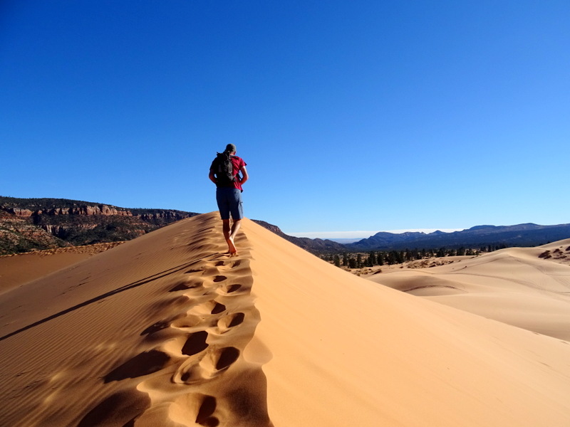
Barefoot sand dune hiking
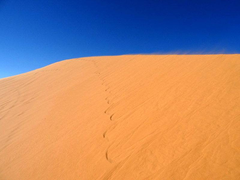
We’ve hiked around a lot of sand dunes. Before we began this adventure, sand dunes were one of the things I had on my list of “must explore” items. Countless dunes later, and I still love romping around in the sand.
Last week I got a birthday present to help usher me into old age — hiking poles. I’ve resisted getting hiking poles for years. I’m not sure why I have such a hang up about it. You see people of all ages out on the trail with poles which tells me that the stigma associated with them is mostly in my own mind. I guess it feels a little like giving in to the fact that my knees might not be in tip-top top shape any longer and at times require a little assistance.
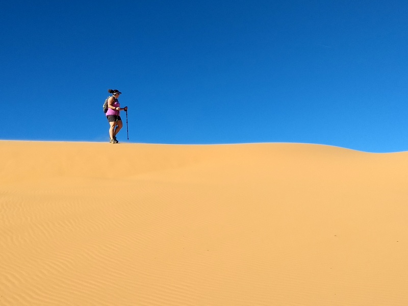
Putting my new hiking poles to good use
After climbing and sliding around for a few hours we made our way back to the parking lot. Even though it felt like we had just hiked many, many miles, our entire track was a measly 1.78 miles. I guess that soft sand makes for quite the workout!
Wednesday & Thursday, October 25-26
I woke up on Wednesday morning feeling like crap. Nausea and stomach cramping is never a good way to start the day. I tried to eat breakfast, but soon ended up back in bed where I stayed for the rest of the day. By the evening I was feeling a bit better and hopped by morning whatever I had would be gone.
No such luck. I woke in the middle of the night with terrible stomach pains and was up for awhile willing them to go away. Most of Thursday was once again spent in bed. Between the nausea, body aches, and low fever it seemed that I had caught some sort of stomach virus.
Fortunately, by early evening I was starting to feel better and was even hungry for the first time in days. Phew…I think I kicked this thing. Hopefully, Tim doesn’t get it next.
Friday, October 27
It was with great relief that I woke up this morning feeling healthy, well rested and ready to tackle the day. I was feeling so good that I decided to head to the Grand Staircase visitor center to sign up for the daily lottery to get a permit to hike the Wave. Even if you don’t recognize it by name, you’ve probably seen photos of the colorful area of slickrock called The Wave.
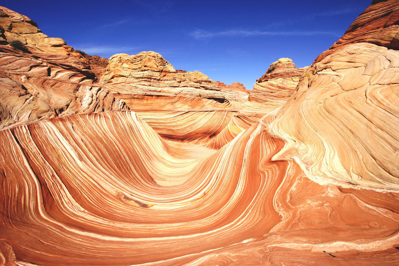
The Wave – Photo courtesy of Flickr user DIVA007
At one time this was a seldom visited natural wonder known only to locals. As tends to happen, word got out and eventually the BLM started enforcing a strict permit system in an effort to keep the area from getting ruined. What I find most interesting about this story is that the rise in popularity occurred back in the ‘80s, long before the Internet and social media. Instead of Instagram and Facebook, it was printed guidebooks with glossy photos that drew in the tourists. Just a little reminder that even before the Internet we had a long history of overusing our natural wonders.
For many years the limit was eight permits per day, but after the 2002 Olympics tourism in southern Utah increased and they raised the limit to 10 per day. What was supposed to be a temporary increase was never reverted and currently they give out 10 online and 10 in person permits.
We have never discussed trying for a permit before simply because there are so many non-permitted places in southern Utah to visit. But with the timing working out perfectly, we figured why not. The process is fairly straightforward. You show up at the visitor center at 8:30, listen to a short talk about the hike and then file into a conference room to fill out your request for a permit. At 9 on the dot, a park service employee rolls a bunch of wooden balls around in a cage until one by one thy pop out and he calls out the numbers and corresponding name.
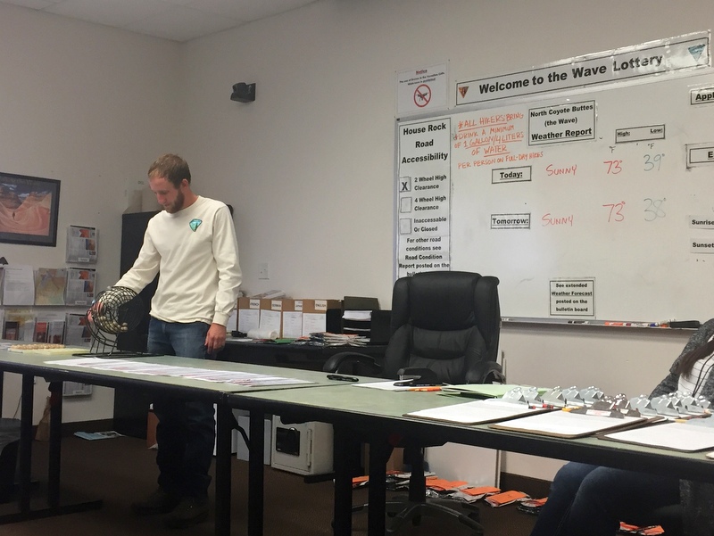
Please call my name…please call my name…
My name was not called. With 70 people competing for 10 permits I was not surprised. There was one woman in the crowd who had tried for six days in a row to get a permit. When he called her name we all cheered :)
Later in the day, we took a short drive up to Orderville to hike the Red Canyon trail. We knew ahead of time that it would be a very short hike along a wash and through a slot canyon that ended at a tall pour over. I was still trying to take it easy from the last few days of yuckiness, and it ended up being the perfect way to stretch my legs without overexerting myself.
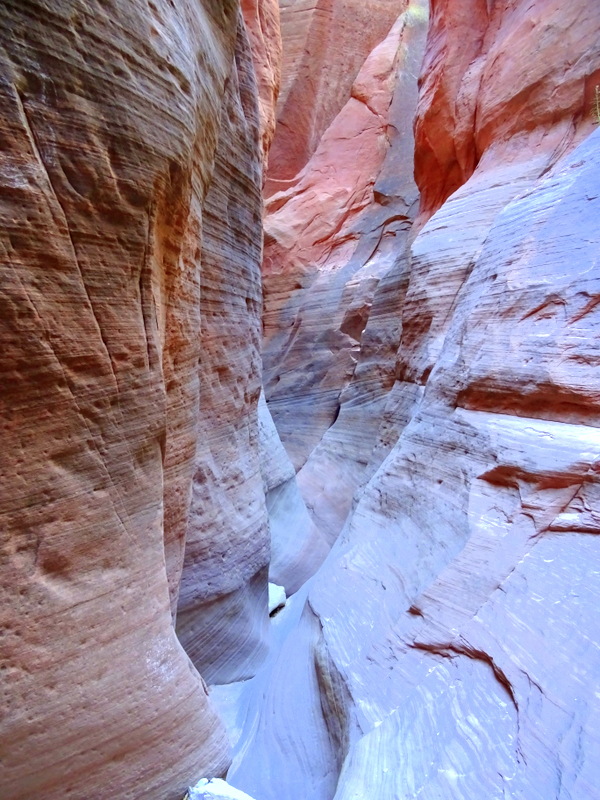
A short, sweet little slot canyon
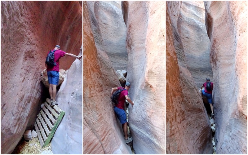
Climbing, squeezing & more climbing. A shout out of thanks to whoever left that pallet behind!
On the way back from the slot section we climbed up the side of the canyon and found some rocks to sit and enjoy the sun.
Not every hike needs to be amazing. Sometimes getting outside and enjoying the sunshine is enough.
14 comments
My gosh, we’ve got to go back to Bryce!
I you are looking for another spot –we really liked Snow Canyon west of Zion just outside of St. George. I’d like to try the east side when we come out next fall- that boondocking site looks great.
Thanks! Several other people have recommended it, and we actually thought we might head over there, but then we heard that the cell signal wasn’t the greatest and decided to skip it for now.
You absolutely have to visit Best Friends Sanctuary! We volunteered for them many times and stayed at the sanctuary, walking dogs, hanging out with the cats. It’s a place any animal lover needs to see at least once.
Oh, and there’s a cool little grocery store near Nedra’s Too in Kanab – Val is the owner, really nice woman. Lots of organic produce and goodies.
We did think about visiting Best Friends, but then I got sick and we lost two days. We have since moved on from the area, but I can see us spending more time there in the future. That little grocery store sounds like so much fun!
Thanks again for taking me places I’m unlikely to ever see in person – the views are spectacular and your hardiness is certainly admirable!
another great post.. the added info on photos, angles landing etc., was very helpful and COOL.. thanks
I thought adding the graphics to the canyon photos would be helpful. Angel’s Landing is a trail many people have heard of, but not seen in person. This is a really unique viewpoint that shows the trail in a way you can’t see from down in the canyon. Happy that you enjoyed it.
On your way out of Page towards Grand Staircase, you would have passed a BLM office. When we stopped there in April, 2016, we met Merle Graffam who, in addition to being a BLM employees, is also an amateur paleontologist. He discovered a dinosaur fossil skeleton while out hiking which turned out to be a new species. The area had never before been explored and was unknown territory for fossil hunting. I believe he said there were now three teams exploring the area who have discovered 4,000 dinosaur specimens and four new species within 35 miles of the centre. Merle was incredibly knowledgeable and had the honour of having the dinosaur he discovered named after him. Nothronychus graffami.
http://phenomena.nationalgeographic.com/2015/08/15/paleo-profile-nothronychus-graffami/
Wow! That is amazing. Thanks so much for sharing!
Thanks so much for those Zion photos showing Angels Landing and Observation Point. Although we were there last year and hiked up and past Angels Landing to the West Rim trail, I never had an understanding of where Angels Landing was in relation to the road. We’re thinking of going back this spring and will have to do Observation Point. Looking forward to reading about your adventures there later this month!
I also never quite understood the Angel’s Landing trail until we saw it from this vantage point. It really demonstrates how skinny that ledge is! If you enjoyed hiking to the West Rim trail I would highly recommend Observation Point.
Thank you for this post! I’ve been trying to figure out the next road trip your photos of the coral pink sands inspired me! Hope you and Tim are doing well!
Have fun! We love sand dunes and the special color of this one made it even cooler!