This week we’re boondocking near Steamboat Springs at the top of Rabbit Ears Pass.
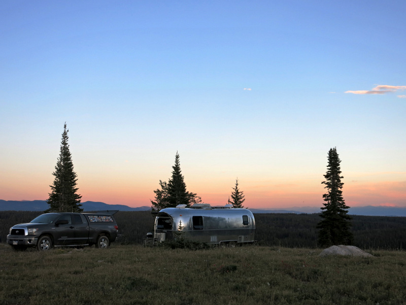
At the top of the world
Since this is our first visit to the area I did a ton of research before we arrived on our options for places to stay. Initially, I was attracted to the state park alongside Steamboat Lake. But after studying the coverage map, I decided that the cell signal was simply too weak up there for us. Likewise for the national forest and boondocking spots nearby. So I set my sights a bit further south to an area called Rabbit Ear’s Pass. There I found two suitable national forest campgrounds, Dumont Lake and the Meadows Campground. The Meadows sounded especially nice with open sites, an easy 20-minute drive into town, and a strong Verizon signal. But since we’ve learned that you can often find good boondocking spots near national forest campgrounds (check with the forest service first through because sometimes there are restrictions and pockets of private land that don’t always show up on maps) I decided to see what I could find nearby. A quick Google search and some looking around on the satellite view map confirmed my hunch. Rabbit Ears Pass is a well-known boondocking area with several forest service roads that looked suitable for our needs.
The road we chose had a few spots that looked just about right (from what I could tell from the satellite view images), but the very best spot was at the end of the road. So we drove up 7 miles of dirt road, passing by a few so-so looking spots, eager to see what it looked like at the end. Turns out that it looked great!
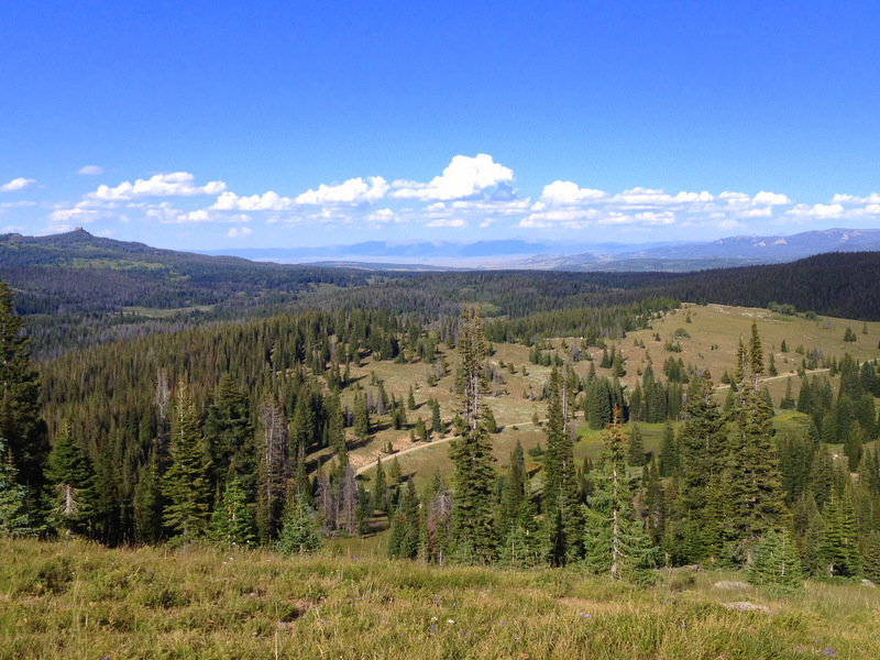
The view from the top of the road
The road ended at the top of a hill – or rather a mountain, we are up above 10,000 ft after all – with a large open space containing a building and some towers. Past the building was a short dirt road that traveled to the edge of an overlook. There we found a flat, wide open spot perfect in every way. Except for one small detail. The short road from the building to that perfect spot was riddled with deep potholes and sharp rocks. It really didn’t look like we’d be able to drive over that with the Airstream.
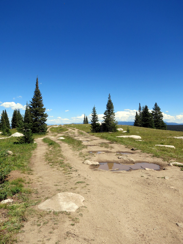
In between us and paradise is this horrible road
Tim suggested that we could just park in the flat spot next to the building under the tower (which turned out to be some sort of FAA tower), but that view…how could we pass that view up? So we decided to give the road a shot. I crouched down low and watched the clearance under the Airstream as Tim slowly inched his way across the rutted, rocky road. I’ll spare you all the mundane details, but basically, it took three attempts before we found a viable route that would not rip off our holding tanks or puncture one of our tires.
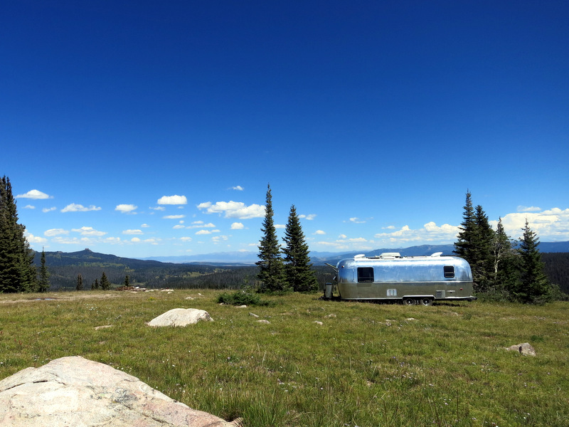
Our perfect spot
As sometimes happens when we find ourselves in such a beautiful spot, we’ve barely left since arriving. There was one trip into town for groceries and to do some much-needed laundry, but other than that we’ve stuck close to home enjoying the views and a few amazing sunsets.
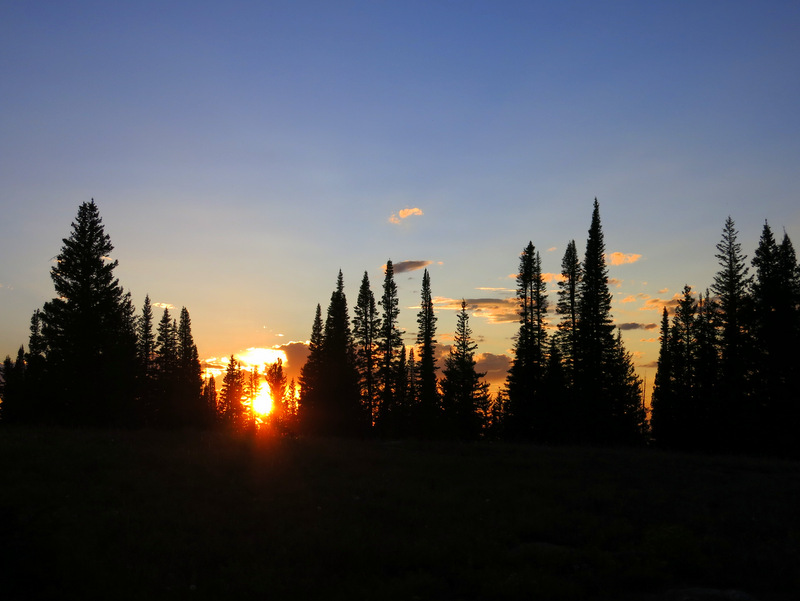
Sunset through the trees
It’s also been raining quite a bit, which deterred our plans for hiking a few days in a row. But on the plus side, the storms tend to blow through quickly around here with intense bursts of sun between. And we all know what rain followed by sun means. Rainbows!
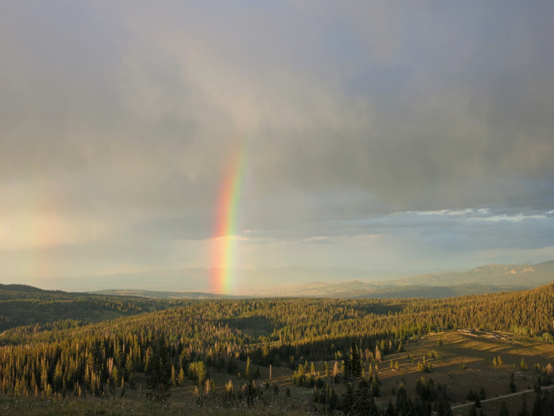
Rainbow time
We plan to stay in this same spot for a few more days and have the best intentions to get out and do some exploring over the weekend. But for now, we’re sticking close to home, watching the clouds and sun chase each other across the sky, and enjoying our view from the top of the world.
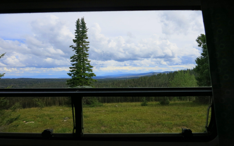
Bedroom window view
10 comments
You find the most amazing sites! Looks like it was worth the effort.
It was definitely worth the effort!
You two find the best spots! Thanks for sharing this information. Good job on not tearing up the airstream. Lovely view! Grace (in Tucson)
Since we spend the majority of our time at home during the week, we try to make an extra effort to seek out the good places. This one ranks pretty high up there on the awesome scale :)
Amazing spot! So beautiful! I found a great side benefit to the peach guac – it doesn’t turn brown even after three days and still tastes delicious. Thanks again for the link love.
Ohhh! Good to know. We ate our batch in one night so I didn’t get a chance to test it’s lasting power.
You two scope out the most spectacular spots. We are heading to Colorado soon and hope to find a few gems of our own.
You’re sure to find some good spots in CO. It’s pretty hard to go wrong in this beautiful state.
Hello.
Looking at the map, I cant tell where you actually camped… ( I cant find the building or the radio tower ). Would you mind sending me some coordinates of where you actually stopped? Also, I wonder if it is too snowy to head up that high this time of year.
Here’s a link to the spot: https://www.campendium.com/forest-road-302-routt-nf
Also, we always post our GPS coordinates on the big list under the Where page.
We were just in the area last week and by-passed this spot for another one at a lower elevation and closer to town: https://www.campendium.com/rabbit-ears-pass-west. We didn’t check the original spot, but while hiking around we came across a good bit of snow, so chances are there might still be some up there.