This has been a week of lazy blogging. Or to put it another way- no blogging at all. The result is a back log of pictures and stories to share from our hiking adventures here in Zion. Instead of writing four long posts about each hike, my intent was to compile one short post with a few photos and interesting tidbits from each hike. Instead what I ended up with was a rather long post with more than a few photos and more than a few tidbits.
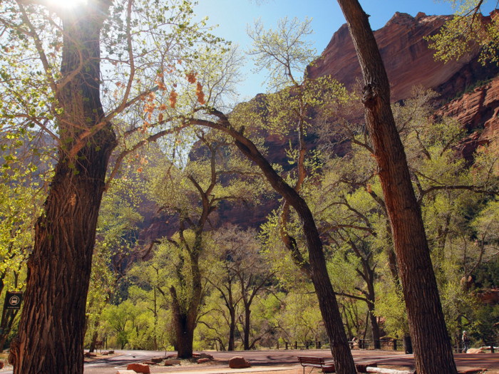
Spring has sprung here in Zion Canyon
Oh, and by the way we have been using a site called Joe’s Guide to lead us through our Zion hikes. I’ve linked the title of each hike with Joe’s description is you want more info about any of the hikes.
West Rim Trail:
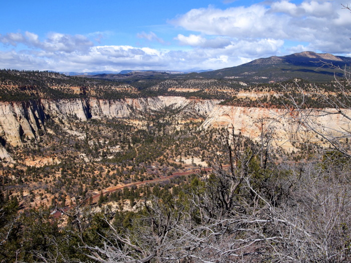
We hiked only a small portion of the 16 mile West Rim Trail. This backcountry trail travels from the highest point in Zion, Lava Point at roughly 7900′, down to the main canyon. Most people who hike the entire trail do it in two days, spending a night at one of the nine designated campsites along the trail. Reading about this trail, and hiking a portion of it, made us wish we were set up for overnight backpacking. It sounds like an amazing journey through some seldom visited areas of the park. Instead, we settled for the most popular section of the west rim trail- starting at the bottom of the main canyon and hiking up to Scout’s Lookout. The trail started off innocently enough with a gentle uphill trek to the bottom of a saddle between two tall cliffs.

An easy start
The feel of the trail changed rapidly as we approached the cliff base and began to climb the first set of switchbacks. The ascent is steep, but the paved trail turns what could be an impossible climb into hike that pretty much anyone can conquer.

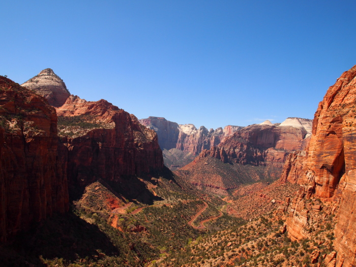
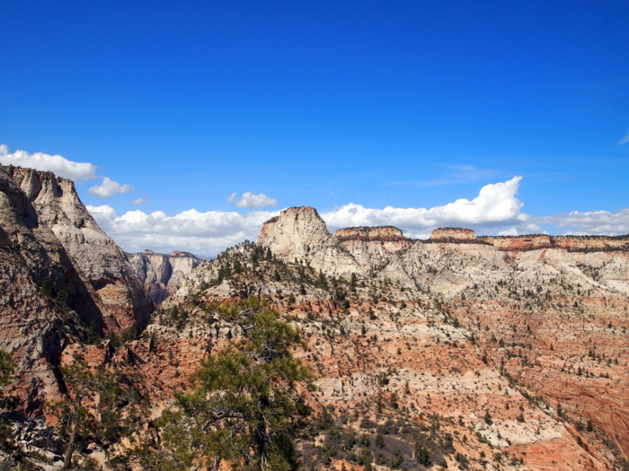
Looking down on where we just hiked

View of the Zion Canyon to the south
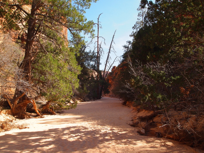
After the switchbacks we were treated to a welcome flat section through the shady and cool refrigerator canyon.

A cool down in refrigerator canyon
Next up was another set of short switchbacks before we reached the famous Walter’s Wiggles. The Wiggles are series of 21 zig zag switchbacks built in the 1920s and named after Walter Reusch, the first superintendent of the park.

Walter’s Wiggles- up & down
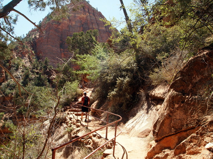
After conquering the wiggles we reached Scout Lookout where the Angel’s Landing trail turned to the south and the West Rim trail continued to the north. Angel’s Landing is probably the most famous hike in the park, due both in part to the incredible views at the top and also the dangerous nature of the hike. The trail follows a very narrow 1/2 mile ridge with 1,ooo’ drops on either side. The engineers of this hike thoughtfully provided support chains for those wishing to climb the ridge. In addition to being the most famous, Angel’s Landing is also one of the busiest.

Start of the Angel’s Landing trail
You can’t tell from this picture, but when we arrived at Scout Lookout there was a solid line of people hiking both up and down the ridge. If we hadn’t already set out to continue on the West Rim trail instead of heading up Angel’s Landing, seeing the crowded trail would have cinched our decision. While a steep, narrow trail doesn’t scare us away- a steep narrow trail crowded with people is enough for us to say no thank you.

A very narrow trail
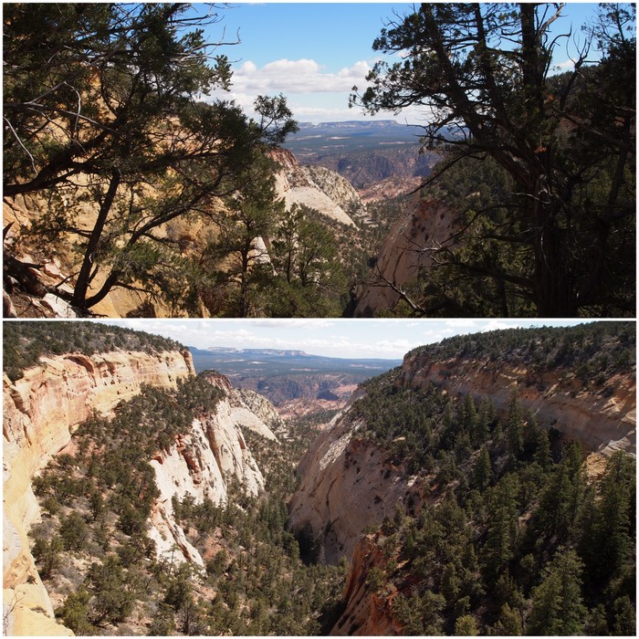
The West Rim trail headed north up a sandy path and on to a wide expanse of slickrock.

Up a sandy path

At the top of the rim
We made our way around to the west with the intent of finding a view of the trail we had just climbed.

Angel’s Landing & Walter’s Wiggles
After following the West Rim trail for a few miles it began a descend down into a valley below. This seemed like the perfect place to turn around since going down meant we would have to come back up, and we had enough uphill for one day!
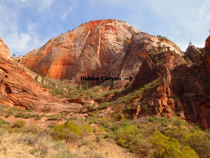
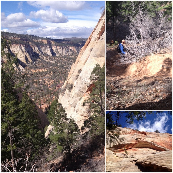
Hidden Canyon:
This is another trail in the main canyon with steep uphills and long drop offs. Definitely not a hike for those with a fear of heights! It was a short hike though, and at the end our reward was the surprise find of a small arch set back in the canyon. The hike to Hidden Canyon starts at the same trailhead as the hike to Observation Point that we did last week. After a roughly 3/4 mile trek up the switchbacks, the trail turned right and continued into the canyon.
In search of the hidden canyon
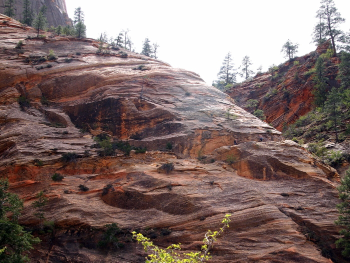
Another set of short switchbacks later and we reached the exposed part of the trail which skirts around the edge of a steep cliff. Look closely and you can see people on the trail.
A trail sculpted into the cliff
Along the way there are chains bolted into the cliff for obvious safety reasons.
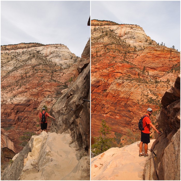
Tim behaving himself and using the chains
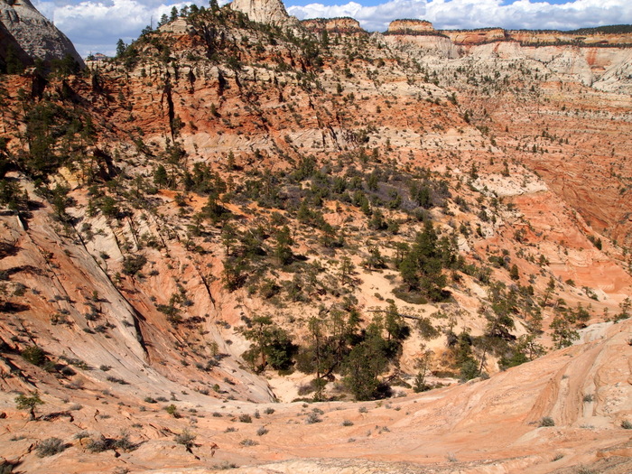
We made it up and around the cliff and into the hidden canyon.

In the canyon
A short sandy walk through the canyon took us to the arch and the end of the trail.
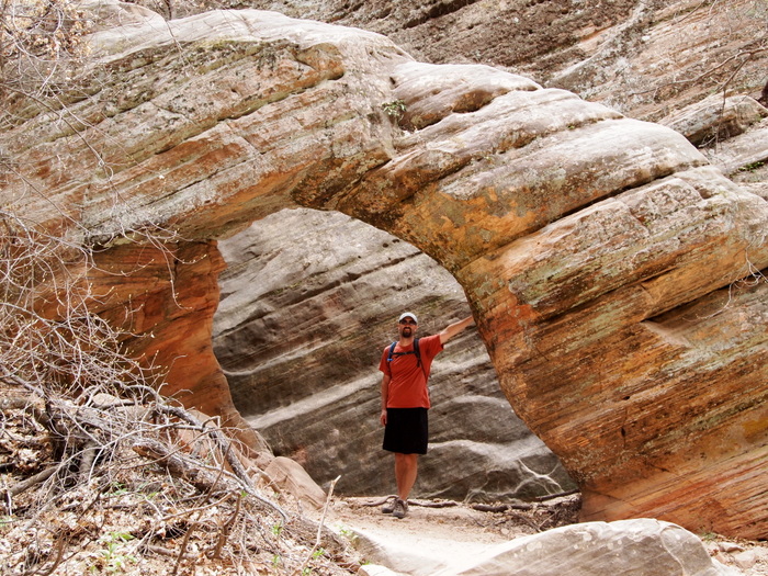
A hidden arch in the hidden canyon
Checkerboard Mesa Canyon or Checkerboard Mesa Wash
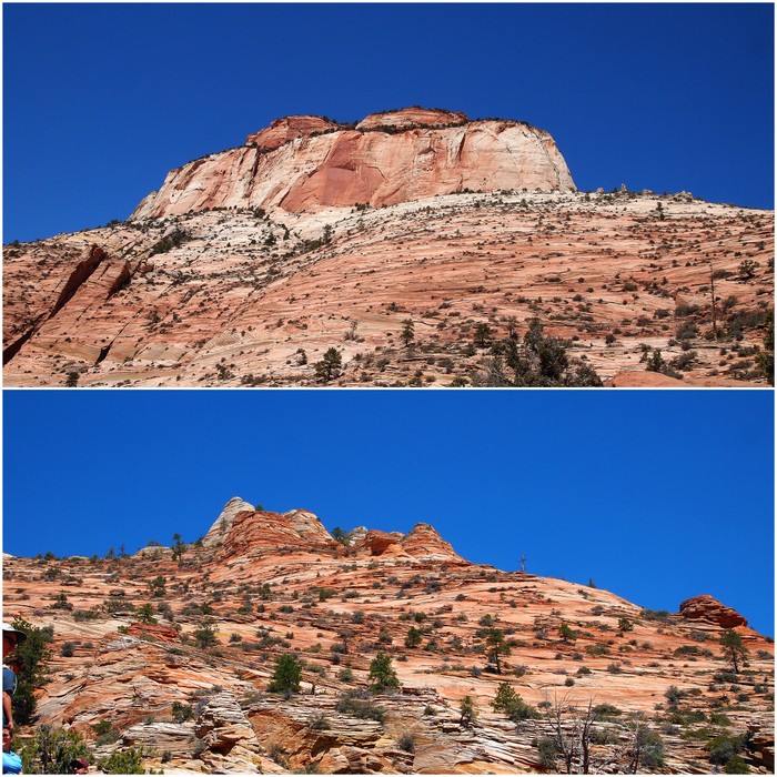
One of the most iconic sights on the east side of Zion is the Checkerboard Mesa. With its unique cross-hatching pattern this rock formation has been photographed by millions of tourists on their way through the park. And we climbed it! Ha, just kidding. While I am sure someone has climbed this beast, the skill level required is way above our heads.
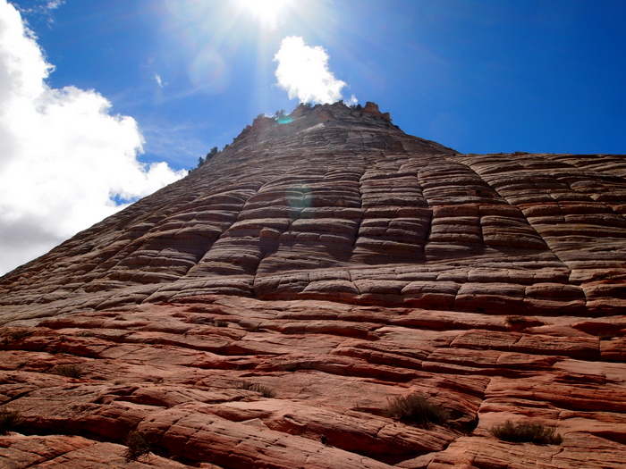
The iconic Checkerboard Mesa
There is a nice hike that leads up the canyon alongside the mesa though. That is what we set out to hike. Except that’s not what we ended up hiking. Somehow we parked at the wrong parking area and hiked up the wrong side of the mesa- oops.
Hiking around the wrong side of the mesa
Consequently, what we thought was going to be moderately strenuous hike up a canyon ended up being a crazy steep bushwhacking adventure up a ravine of sorts. What threw us off was the fact that we were in fact hiking up a trail. A crappy trail that at times disappeared into a tangle of overgrown bushes and tree limbs, but a trail nonetheless. It was an incredibly steep trail. The pictures don’t even begin to capture the crazy incline of this trail. Not only was it steep, but it was sandy which meant you were sliding down as much as you were climbing up.
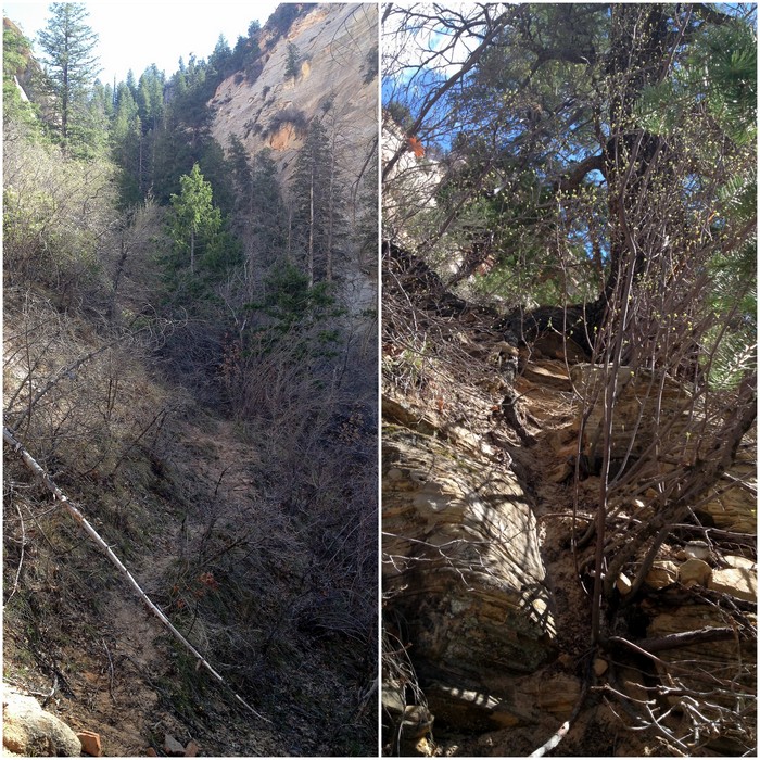
A trail, or not a trail?
A steep trail with a good view
Thankfully the trip to the saddle was short — only about a 1/2 mile. In that 1/2 mile we gained almost 1,000 feet in elevation! I told you it was steep. From the saddle we had an okay view to the north and an amazing view to the south.
At the saddle looking north & south
A very short scramble up a steep embankment brought us to the top of the mesa. From there we walked to edge where we found a wide open view of the eastern edge of the park.
Looking down on the east entrance to the park
It turns out that the hike we did is an actual trail, although judging from the condition I don’t think it’s very well used. While the hike we set out to do on the west side of the Mesa is called the Checkerboard Mesa Canyon, the trail we actually hiked on the east side of the Mesa is called Checkerboard Mesa Wash. I’ve included links to both descriptions in the title of the hike. If you want to hike around the Checkboard mesa my advice would be to try the canyon before the wash. In the end you’ll get the same view from the top, but it sounds like the canyon is less steep and easier to navigate.
East Temple Loop:
The East Temple loop is an unmarked adventurous journey through some seldom visited portions of the upper east canyon. The loop begins on the popular and family-friendly Canyon Overlook Trail.
The family-friendly portion
An easy half mile hike later and we had reached the overlook with a view of the main canyon below. The road in the distance leads up into the Zion-Mt. Carmel tunnel.
At the top of Canyon Overlook
Looking up and east we could see the East Temple and some hoodoo rocks to the south. Our destination was 1000′ feet above at the saddle between these two rock formations.
East Temple & Hoodoos rock formations
Since this is an unmarked trail our goal was to scramble up the slickrock, following what we deemed the safest path with a little advice from Joe.
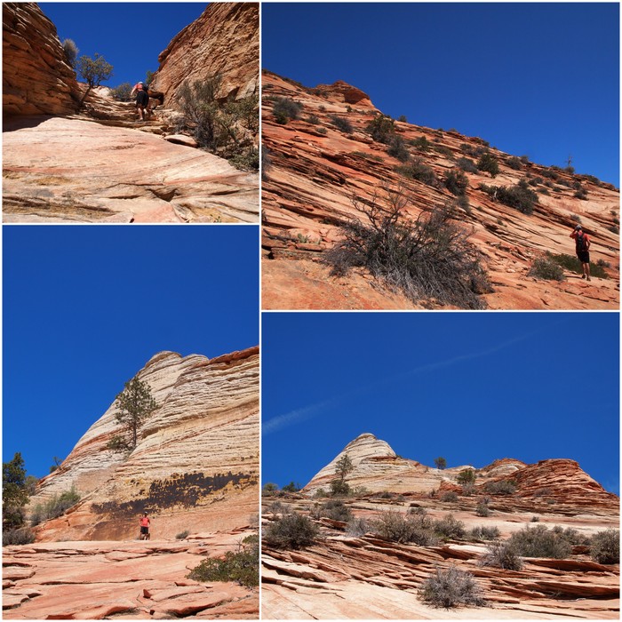
Climbing the slickrock
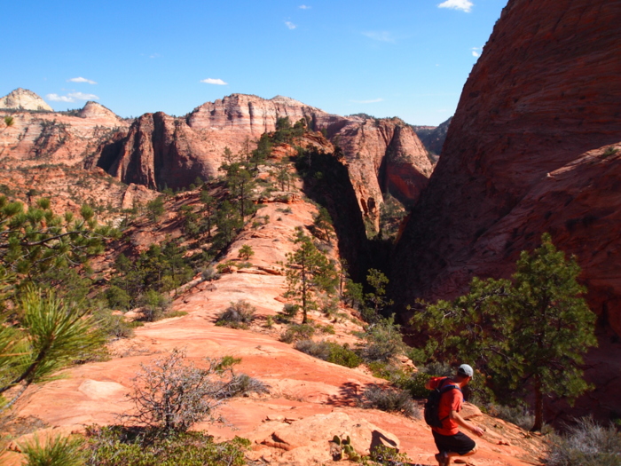
The trip up was exhausting, exhilarating, and at times a bit scary. We persevered though and were greeted at the top with a wonderful view of the east canyon and the mountains to the north.
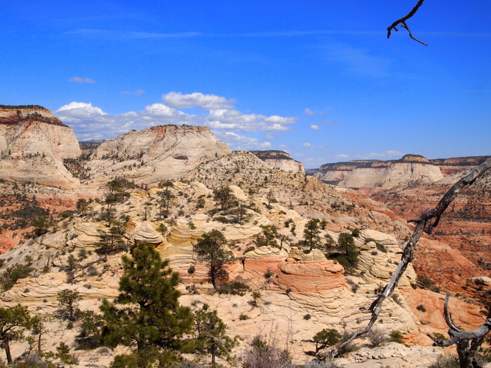
At the saddle looking east
Mountains to the north
Our next goal was to hike down into a wide bowl and then to the wash below. If it looks steep, that’s because it was! We managed to travel sideways around the north part to of the bowl and avoid the steepest part, but there were a few sections with slippery sand covered rock that we didn’t enjoy.
Dropping down into the bowl
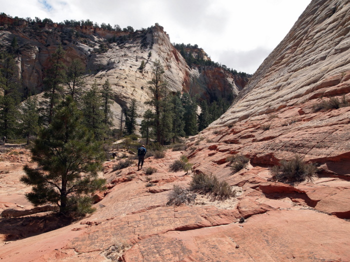
At the bottom of the bowl we hiked along a short, wide wash enjoying the amazing sandstone rocks along the way.
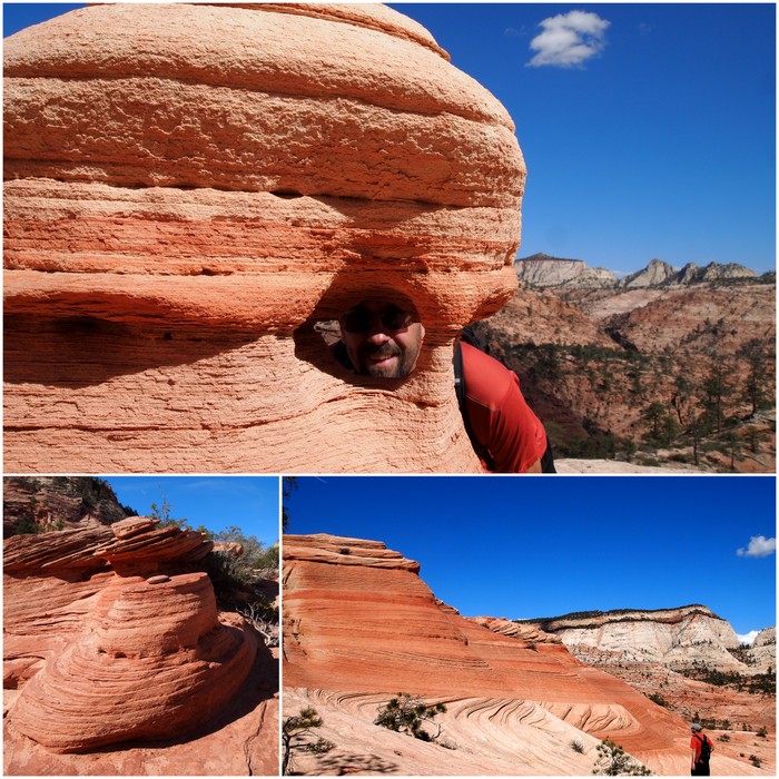
Love that sandstone
Then we arrived at our final obstacle – the ominous Shelf Canyon. Joe had warned us that we would come upon this deep, deep canyon and his advice was to hike north and around the top of the canyon.

A detour around Shelf Canyon
After one false attempt where we didn’t go far enough north and were faced with a way down that can only be described as scary, we found a safe way around and hiked to the shoulder below.
Coming down onto the shoulder between Shelf Canyon & Upper Pine Creek
From the shoulder it was an easy hike down the east side into the the dry wash of Upper Pine Creek.
Ahh..back on flat ground
A few words of wisdom if you are planning to hike this trail:
* Follow Joe’s advice. His description for this hike is spot on, and for this self-guided tour through some potentially dangerous territory it’s pretty important that you have a little help.
* Don’t even think about attempting this hike if you are afraid of heights or don’t have confidence in your ability to scramble up, and down, the slickrock. The first portion of the trail above the Canyon Overlook was much steeper than it looked in the pictures. That’s all I am going to say.
*Good navigation skills and tools are a must. We wrote down Joe’s directions and brought our handheld GPS with us. Both came in handy numerous times.
With all that said, this was one of the most adventerous hikes we have been on. We loved the challange of finding our own trail and traveling through the awesome slickrock of the upper east canyon.
Well there you have it- our last four hikes in Zion. Today we are heading north to Moab where the hiking adventures continue in Arches National Park.
10 comments
Looks like you had a wonderful time in Zion. So glad we found Joe’s website. It sure made for some awesome hikes that were a little off the beaten path.
Where are you going to stay in Arches?
Yes- thanks for finding his site! It was a great way to explore the lesser known hikes in the park.
There’s a number of BLM campgrounds along Hwy 128 at the bottom of Arches. We’re going to try and find at spot at one of them. We won’t arrive until tomorrow because we’re leaving here mid-day and then spending the night at the Walmart in Richfield. This way we can arrive at the campground in the morning and have a better chance of getting a spot.
We love Zion! Wonderful photos you took of your hikes. It’s just so beautiful there.
Our honeymoon was spent in Zion but we only got to Angel’s Landing & The Narrows. We’d love to go back to explore some of the other trails.
I bet it was a wonderful place for a honeymoon!
Fabulous photos. Looks like a wonderful week of exploring.
We hope to do Utah next fall. Thanks for sharing.
I am sure Utah in the fall is amazing!
Wow! What great pictures and descriptions. Glad there are people adventurous enough to show us these hikes. Thanks for sharing!
You’re very welcome! We had a blast exploring this park and especially enjoyed seeking out some of the lesser known hikes.
Between the two of you and John and Pam Wright, we should be all set for hikes whenever we get to Zion. Thanks for a great post.
Thanks for all the great info. We used it in our shelfcanyon hike