Well we survived our short detour to Charlotte, NC and are now back in Tennessee. To be more specific, Tim survived three days at the office, while I survived three days of being stuck inside at an RV/mobile home park while it rained. I know that it can’t possibly rain all the time in Charlotte, but both times we have visited it has rained every day which doesn’t do much for my impression of the city. We did smarten up this time around by staying at an RV park much closer to Tim’s office which cut his commute time down from the 45 minutes he endured last spring at the McDowell Nature Preserve, to only 15 this time.
The downside was that the park (Elmore RV Park) was in a not so desirable area with no nearby parks or walking trails. After two days stuck inside I drove Tim into the office on Friday thinking that I could find a park for some exercise…and then it started raining and continued on and off all day, despite the fact that the weather forecast had been calling for sun. Makes me happy that we live in a house with wheels.
It was still raining when we left on Saturday morning to head back west into Tennessee. Once again, the weather forecast called for the sun to make an appearance on Sunday (we must be some kind of suckers to believe that the weather can ever be accurately predicted) so we decided to forgo I-40 in favor of Rt. 441 through the Great Smoky Mountains National Park. The plan was to spend the night in the park and then wake up to a gorgeous sunny day perfect for hiking.
A quick stop at the Oconaluftee Vistor Center
We spent the night at the Elkmont Campground only a few miles inside the eastern entrance to the park. It was nearly dark by the time we arrived, and while it wasn’t raining it was quite chilly, very damp, and foggy. Despite having zero cell service we somehow made it through the night. I’m only half joking when I say we barley survived a single night with no Internet. I know many people love the idea of disconnecting while they camp out in nature. We are not those people. We prefer our nature come equipped with a blazing fast LTE signal :)
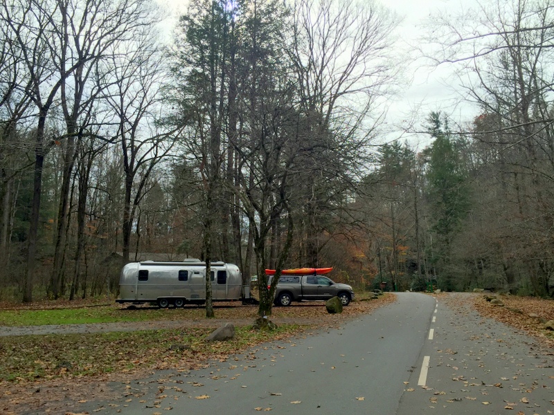
Elkmont Campground
The next morning it was still overcast, but we had hopes the sun would break through at some point. We drove up to the top of the road and by some miracle found an overlook pull-off with designated RV parking spots. Despite the thick cloud cover, the view was still pretty nice up there at 5,000 feet.
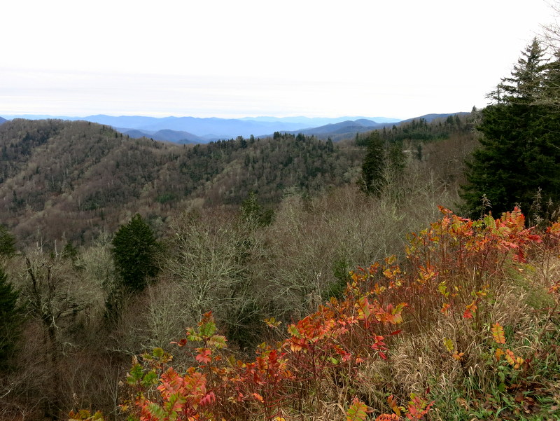
No leaves left on the trees at this elevation
Our hiking choices were fairly limited with the Airstream in tow. We either needed to find a trailhead with enough space to park, or we needed to drop the Airstream at the visitor center and drive the truck to a trail. One of the hikes we had our eye on was the Alum Cave trail. Easily accessible off the main road, this is understandably a popular hike, and despite the cold, cloudy weather the trailhead parking lot was packed with cars that spilled out and lined both sides of the road. I was sure there was no way we would find a spot, but about a 1/4 mile from the parking lot we found another pull-off with zero cars. Almost like it was put there just for us.
The hike up to the cave was around 2.5 miles one way. It started on fairly flat terrain alongside a river. Most of the trees at this elevation had already dropped their leaves for the winter, but the plentiful wild rhododendrons provided a pop of dark green color. I would love to hike this trail in the spring when they’re all in bloom.
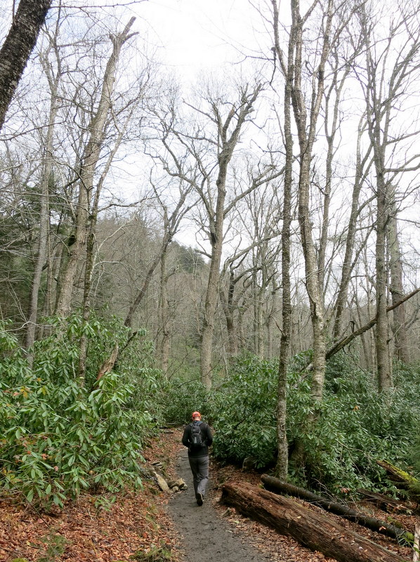
The evergreen Rhododendrons provide a great contrast to the bare trees
We crossed several log bridges and under a rock tunnel as the trail gradually increased in steepness.
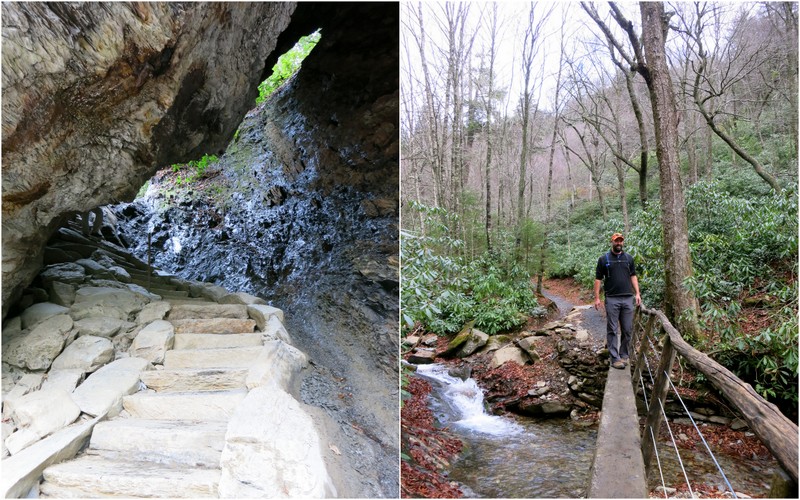
Fun stuff on the trail
The alum cave is not really a cave, but instead a concave bluff reaching around 80 feet high and 500 feet long. It was nearly impossible to take a photo of the whole thing, but the size of those people in the lower left hand corner give an idea of just how big this bluff/cave really is.
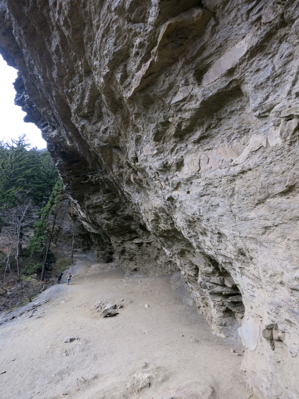
Tiny people, big rocks
On the way down the sun finally decided to make an appearance treating us to a view of the evergreen covered hills.

A bit of sun on the way down
After the hike we continued our drive through the park — this time going down. Even though I knew that this is the most visited national park in the U.S. I was still surprised by how many cars and people we saw on such chilly day so late in the year. We followed a line of cars nearly the whole way and every pull-off we passed was jam packed with cars. If it’s this busy now it must be crazy in the summer!
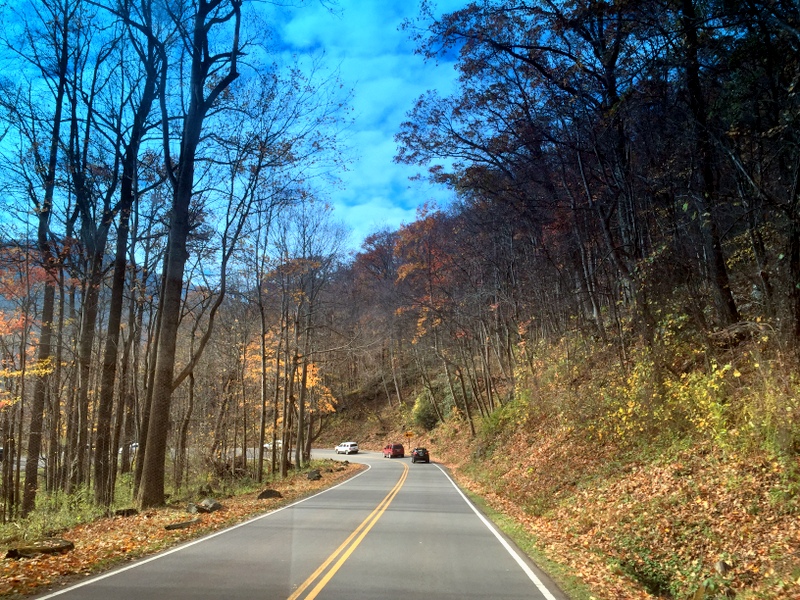
Driving through the park
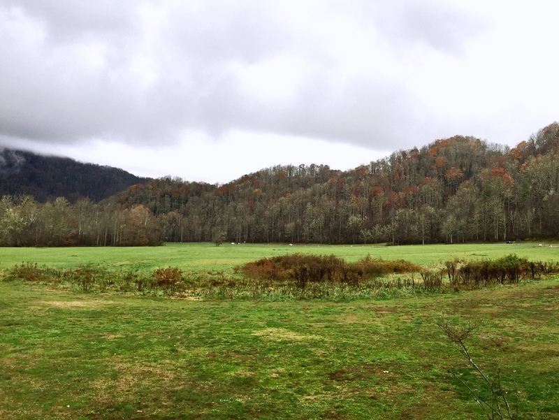
We couldn’t find parking at any more pull-offs, but I did get this one lucky shot out the window. Still some leaves left at lower elevations, but probably not for long.
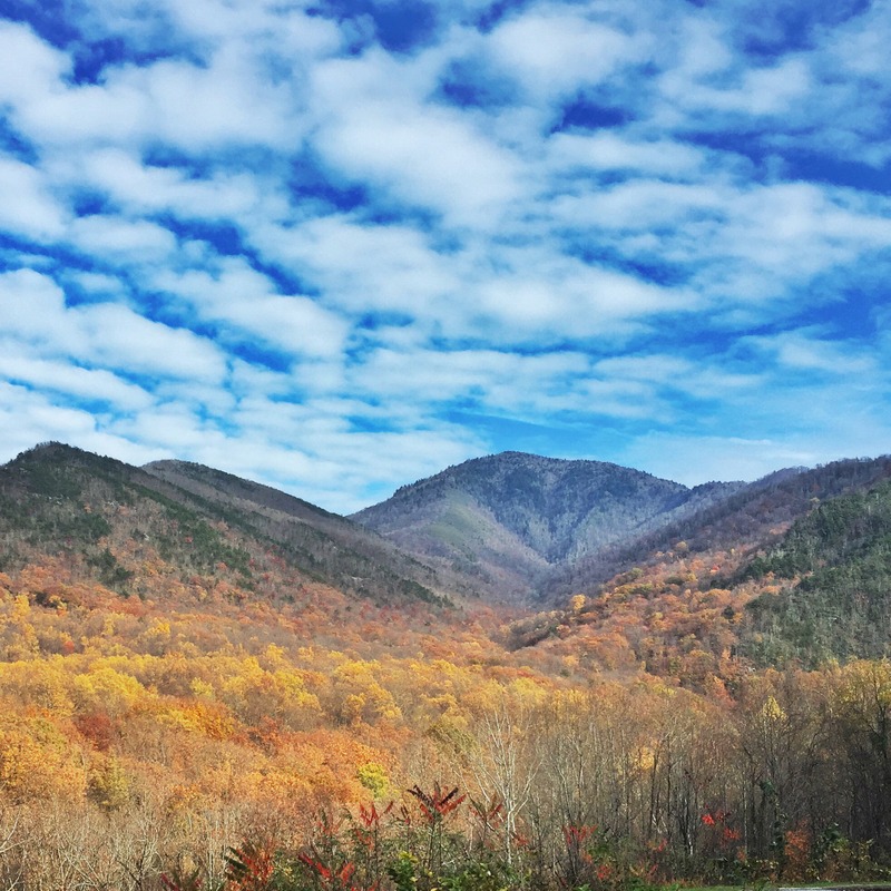
A lucky drive-by photo
After this quick, spur of the moment detour it’s obvious that we need a lot more time to explore this park the next time around. It’s going to be a challenge since none of the in-park campgrounds have cell service (aside from liking to be connected we also need to have it during the week for work), but hopefully we can make it work next fall when we come though the area again.
4 comments
I’m with you — we’re fine going without electricity/water/sewer — but don’t take away my internet connection! :-) Love being out in the middle of nowhere with blazing fast connection. Very nice drive-by photo.
We always get a thrill when we find a remote boondocking spot with no town for miles — and it has a speedy connection. Nothing better :)
Guess you were supposed to hike that trail if there was RV parking nearby :-) At least when I had the rig to myself in a crappy neighborhood the weather cooperated and I could get away from it – glad both the office and that spot are behind you two now! Love the bluff pic – so huge. Great shot from the road.
Yup, as soon as we saw that parking area we knew that was the trail for us. Thankfully the rainy weather seems to be behind us!