During our week long stay at Turquoise Lake we managed to pry ourselves away from the shore for a few hikes in the surrounding mountains. As I mentioned last time, the rainy season is upon us here in Colorado, which made our schedule of hiking after work in the late afternoon a bit of a challenge. Our first attempt at a hike on the nearby Hagerman Pass Road failed miserably. During our drive up the steep, winding road the rain that had started off as a sprinkle began to fall more steadily. Somehow we missed the trailhead for our intended hike, and as we continued up the bumpy, rock-filled 4-wheel drive road, it became apparent that this hike was not happening.
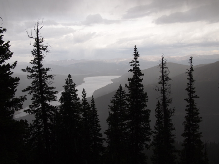
As we climbed higher the rain let up, but dark clouds accompanied by flashes of lightening and rumbles of thunder loomed in the distance. Not ideal hiking weather. So we drove on. Up past the tree line and to a wide open mountain vista where the snow lingers even in July. At one point we came upon a particularly impressive snow field where the banks on either side of the road where taller than the truck. Doesn’t look like this is going to melt any time soon.
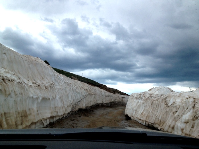
Found some snow
At the top of the pass we found yet another sign for the Continental Divide, and you guessed it…more snow. We chatted with another couple who had come up the road from the other side. And after learning that the drive down was a 15 mile, rutted and rock-filled journey, we decided to turn around and head back the way we had come.
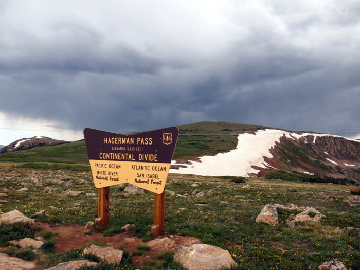
At the divide
As we descended down the pass, the rain began again in earnest and all I could think was how thankful I was that we weren’t out on the trail.
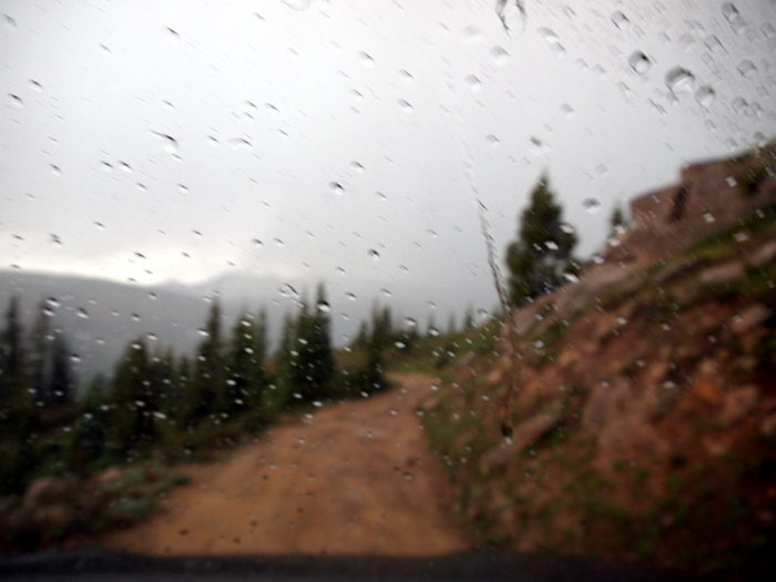
Rain, rain, rain
We did happen to spot the trailhead for our intended trail on the way down the road though, and vowed to return the next day. Return we did and our second attempt was much more successful. This time we completed the hike without even a drop of rain falling.
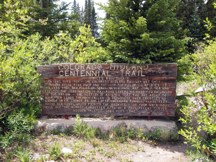
Trailhead for the Midland Centennial Trail
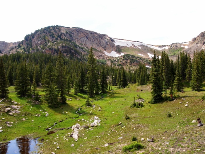
The Midland Centennial Trail follows the track of the old Colorado Midland Railway. In operation from 1883 to 1921, this was the first standard gauge railroad to cross the Continental Divide in Colorado. It ran from Colorado Springs to Leadville, then through the divide at Hagerman pass and onto Glenwood Springs and Grand Junction. Eventually the railroad died out due to financial problems and today all that remains is the old rail-bed and some empty spaces where the trestle bridges once resided. The old rail line makes for an excellent hiking path. The route snakes its way up the mountain at a gentle grade offering mountain views, waterfalls, and wildflowers.
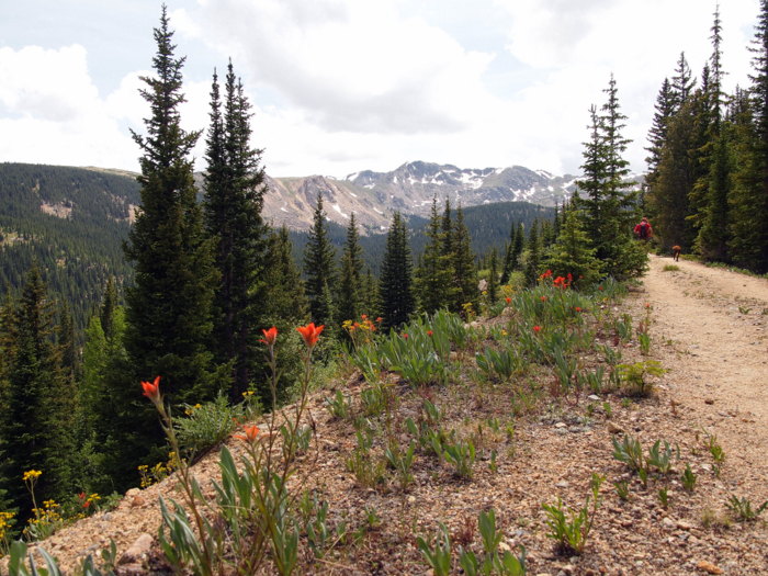
Mountains and wildflowers on the old railroad line
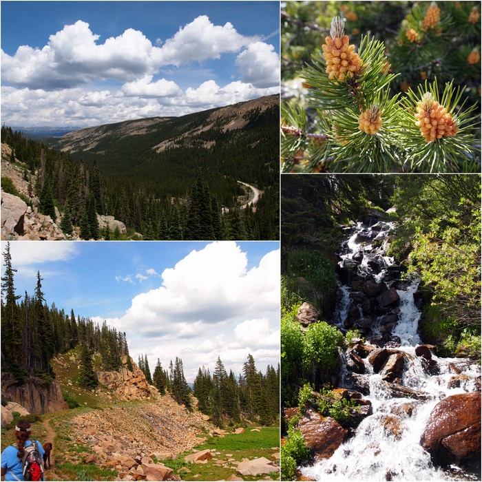
Waterfalls, mountains views, trees with cool pinecones- this trail has it all
We even came upon a ghost town that was once the home of Italian construction workers who helped build the nearby Hagerman tunnel. There’s not much left to the one street town except a few logs where buildings once stood over one hundred years ago.
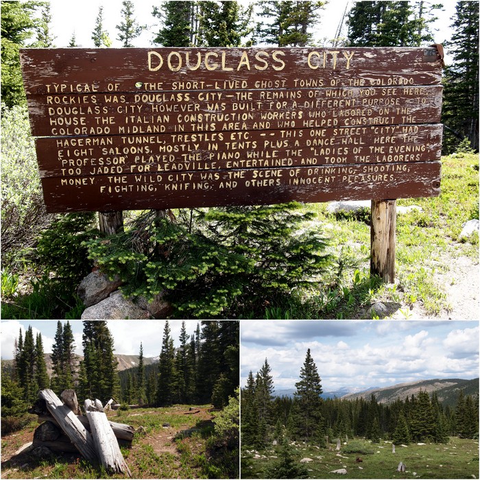
A ghost town in the mountains
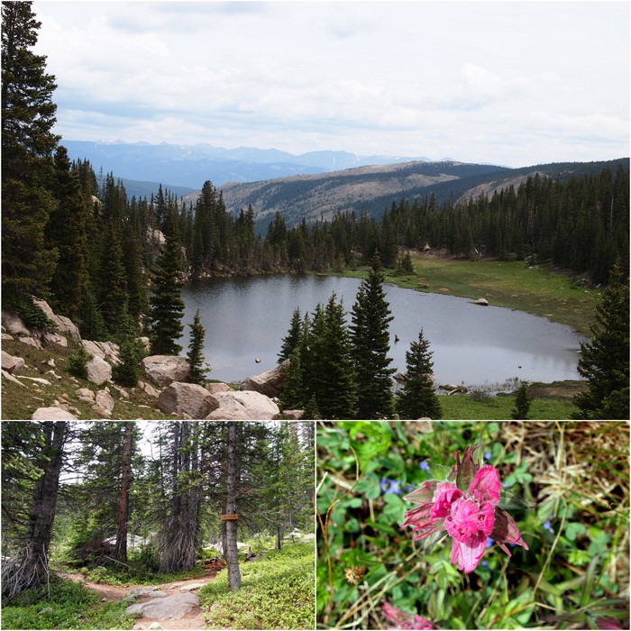
We also came upon a surprise lake and Phineas took a little swim.
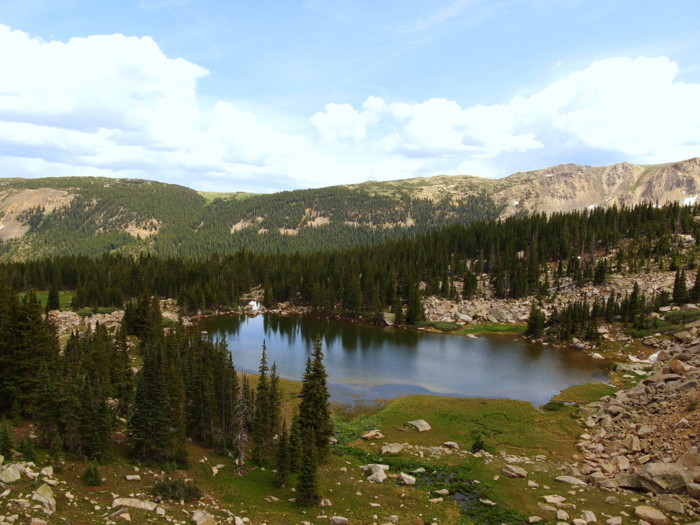
Lake
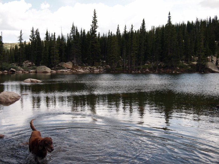
Phineas in the lake
Finally we reached the Hagerman tunnel, where for a short period trains chugged through this 2,160 foot long hole in the side of the mountain. At the time of completion in 1887 the tunnel was the highest in the world at an elevation of 11,530 feet above sea level. Unfortunately, this elevation caused many problems. The railway operations in and around the Hagerman Tunnel proved to be treacherous with numerous accidents and costly snow removal in the winter. Soon plans for another tunnel, the Busk-Ivanhoe Tunnel, which would be located 600 feet lower than the Hagerman, were made. In 1893 the first train traveled through the Ivanhoe and the Hagerman tunnel was abandoned. Today it remains as a relic of the fascinating history associated with the old railroads of the west.
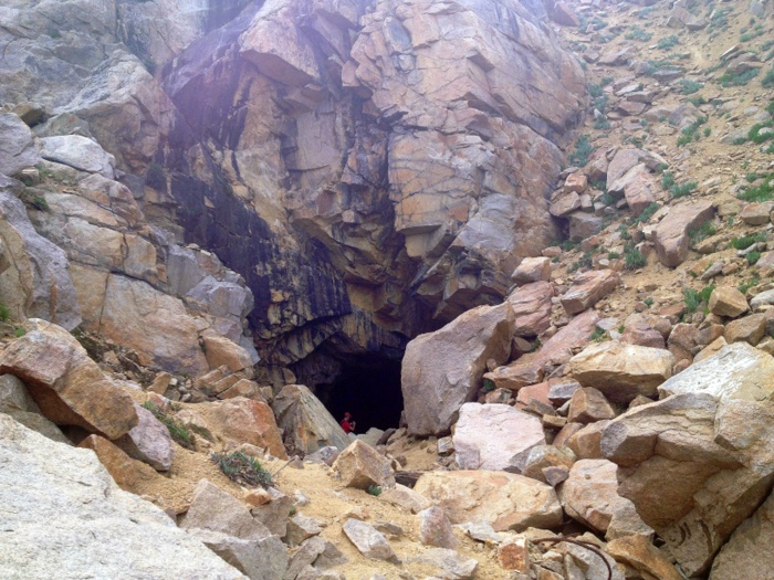
An old railroad tunnel
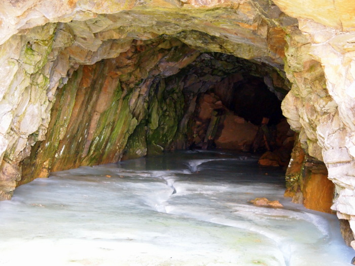
Inside the tunnel- ice!
The Midland Centennial Trail was great hike for anyone even the least bit interested in railroad history.
More trees and mountians
Our next hike on the Hagerman Pass Road was to Windsor Lake. The description for this trail reads as follows: Although short, this trail is very steep and much more difficult than the distance implies. Yup, I would say that is accurate. Although only 3.2 miles round trip, this trail starts at an elevation of 10,900 feet and climbs steadily for 850 feet before reaching the lake. Let me tell you, an 850 foot elevation gain in 1.6 miles when you’re starting above 10,000 is much more challenging than it sounds. Consequently we have very few photos to share from the hike up- I was too busy trying to breathe to take any pictures!
On the trail to Windsor Lake we discovered another smaller lake
When we reached the lake it was wonderful and everything we have come to expect from a Colorado mountain lake.
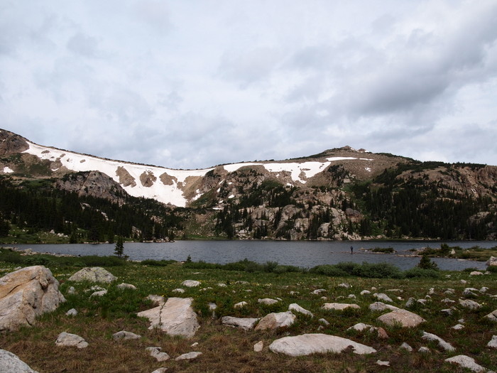
Windsor Lake
Since it was a holiday (the afternoon of July 4th) there was many other people out on the trail. So often we never see anyone else on the trails we hike so this was a great opportunity to have our photo taken by the lake. We hung out for awhile on the lake’s edge watching the people fishing and hiking around the lake before heading back down.
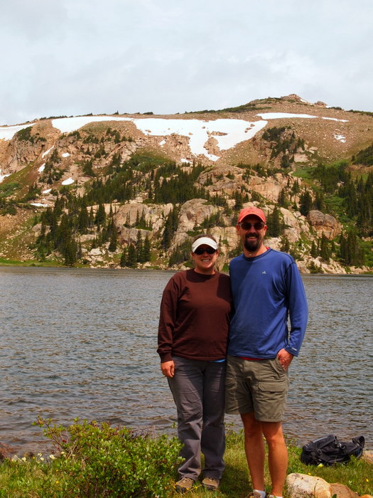
Us at the lake
That concludes our hiking adventures near Turquoise Lake. As usual, one week is not enough time to even make a dent in the hiking trails around the area. Looks like we have found yet another spot to put on the list for a return visit.
7 comments
Well, have I told you that Colorado is on our list of places to explore…I mean stay awhile and really explore? Your post is just another reason why! What a beautiful place. Like Utah, Colorado just seems to have it all…jeeping, hiking, lovely small towns, tons of history, and beautiful lakes! I could go on and on! Thanks so much for sharing…
Have a great week-end!
I agree, Colorado really does have it all. I think we could spend years here and still not discover everything there is to explore.
I have driven Hagerman since 66′ then in a 1948 Willys, now in my extended cab Silverado. Never gets too tiresome to be enjoyed, still love the drive. But I’ve also driven a Cougar XR7 and Cadillac over it, the more luxurious the ride, the longer it lasts.
We just did the Hagerman Tunnel hike and it is everything you described and more! Magnificent vistas, beautiful wildflowers, stunning rocks for the geologists, and lots of history. We have also done the Windsor Lake hike and your description is right on! The beauty of the lake is well worth the climb. Another hike nearby is Native Lake; the trailhead is just prior to the Windsor Lake trailhead as you come up the road from Tourquoise Lake.
I enjoyed your hike and your pictures. My husband and I drove this railroad bed several times and from the west also. We have had a nice time at Ivanhoe Lake on the west side and been stopped by the snow bank you pictured. One man was stuck and said he’d give us a thousand dollars for a shovel which we had . We had lunch on the porch of the ski hut used for skiers in the winter.
1979, hiked up to the railroad tunnel when I was 16, with my dad and sister from the base seen in the drawing picture that hangs in my parents house. Very memorable.
Did you visit the site of the curved 1084 foot wooden trestle? what if anything is left of that landmark? thanks